Dark Mode

Historical Atlantic Cyclone Track and Intensity Records
Data Science and Analytics
Tags and Keywords
Trusted By


"No reviews yet"
Free
About
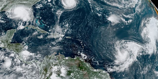
This product offers detailed best track data for Atlantic hurricanes and tropical systems spanning five decades, from 1975 through 2024. It provides critical meteorological and positional attributes for documented storms, allowing users to analyse historical storm paths, intensity changes, and impact parameters. The data originates from the NOAA Atlantic hurricane database best track data. It serves as a foundational resource for climate modelling, disaster preparedness analysis, and historical weather research.
Columns
The dataset contains 13 key variables describing the storms:
name: The official assigned name of the storm.
year, month, day, hour: The date and time (in UTC) when the observation was recorded.
lat, long: The geographical coordinates (latitude and longitude) of the storm's centre.
status: The classification of the storm, such as Tropical Depression, Tropical Storm, or Hurricane.
category: The Saffir-Simpson hurricane wind scale category. This ranges from 1 (64+ knots) up to 5 (137+ knots). 'NA' denotes storms that have not reached hurricane strength.
wind: The storm's maximum sustained wind speed, measured in knots.
pressure: The air pressure reading at the storm's centre, measured in millibars.
tropicalstorm_force_diameter: The diameter (in nautical miles) of the area experiencing tropical storm strength winds (34 knots or greater). Note: This data is only available beginning in 2004.
hurricane_force_diameter: The diameter (in nautical miles) of the area experiencing hurricane strength winds (64 knots or greater). Note: This data is only available beginning in 2004.
Distribution
The data is structured as a tibble containing 22,705 observations (rows) across 13 variables. The data is available in a CSV file format, detailing records for 383 unique storm names across the coverage period. Observations for the time frame suggest reports are most frequent during August and September. The data is static and does not have an expected update frequency.
Usage
Ideal applications include:
Historical Trajectory Mapping: Visualising and plotting the exact tracks of Atlantic storms for research or educational purposes.
Intensity Analysis: Studying how wind speed and central pressure correlate with storm classification and severity over time.
Climate Science Research: Identifying trends in tropical cyclone frequency, strength, and spatial distribution across the decades.
Disaster Risk Modelling: Inputting historical storm attributes into models to assess potential future hazards or risk exposure.
Coverage
Temporal Scope: Data spans a 50-year period, from 1975 to 2024.
Geographic Scope: Covers the Atlantic hurricane basin, with storm centre observations recorded across a wide range of latitudes and longitudes.
Availability Notes: Observations recorded prior to 1979 may have some missing data. Storms observed from 1979 onwards generally have positions and attributes measured every six hours during the storm's lifespan. Measurements for wind diameter are only available from 2004.
License
CC0: Public Domain
Who Can Use It
Meteorologists: For detailed analysis of historical atmospheric dynamics and storm formation.
Risk Assessment Professionals: To calculate storm surge potential and wind damage probabilities for insurance or planning purposes.
Academic Researchers: For conducting statistical analyses on long-term weather patterns and climate change indicators.
Data Scientists: For developing predictive models related to hurricane behaviour and intensity.
Dataset Name Suggestions
- NOAA Atlantic Hurricane Best Track Data 1975-2024
- Historical Atlantic Cyclone Track and Intensity Records
- 50 Years of Atlantic Tropical Storm Data
Attributes
Original Data Source: Historical Atlantic Cyclone Track and Intensity Records
Loading...