Dark Mode

NZ Precipitation and Climate Trends
Data Science and Analytics
Tags and Keywords
Trusted By


"No reviews yet"
Free
About
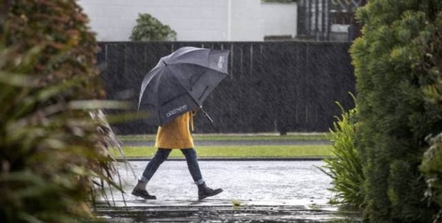
Rainfall is vital for sustaining life, supporting biological systems, and generating power. This collection captures New Zealand rainfall data spanning from 1960 to 2019, reflecting the variations caused by the country's precipitous terrain and location in the 'roaring forties'. Changes in precipitation timing or volume can significantly impact agribusiness, energy, recreation, and the environment. These records allow for the monitoring of rainfall patterns, enabling analysis of potential impacts on crop yields, fish populations, and drought conditions.
Columns
The collection consists of three distinct data files with the following columns:
Daily Data:
- Location: Name of the location (e.g., Auckland).
- date: Date of the measurement (DD/MM/YYYY).
- Rainfall: Rainfall measured in millimetres (mm).
- agent_number: The unique identifier number for the agent.
- station_name_niwa: Name of the recording station.
State Data:
- agent_number: The unique identifier number for the agent.
- season: The season associated with the record.
- precipitation: Recorded precipitation values.
- period start / period end: The timeframe for the state data.
- latitude / longitude: Geographic coordinates of the site.
- site: Site identifier.
- anomaly: Deviation from the reference standard.
- reference period: The baseline period for comparison.
Trend Data:
- agent_number: The unique identifier number for the agent.
- season: The season analyzed.
- trend likelihood: Probability indicator of rainfall.
- period start / period end: Timeframe for the trend analysis.
- P value / slope value: Statistical measures of the trend.
- confidence levels: Low, high, and overall confidence levels.
- intercept / R Squared value / sigma: Statistical regression metrics.
- trend method: The methodology used for trend calculation.
- Additional Metrics: n, note, s, variable s, tau, z, alternative.
- Location details: latitude, longitude, and site.
Distribution
- Format: CSV (Comma Separated Values) across three files: Daily data, State data, and Trend data.
- Size: The daily_data.csv file is approximately 30.2 MB.
- Volume: The daily data contains approximately 657,000 valid records.
- Structure: Structured tabular data.
- Granularity: Daily measurements and aggregated seasonal/period trends.
Usage
- Drought Management: Preparing for irrigation needs if drought conditions are predicted for a specific region.
- Disaster Prevention: Monitoring rainfall accumulation to prevent or predict potential wildfires.
- Agricultural Planning: Analysing historical trends to optimize crop planting and harvest schedules.
- Climate Analysis: Studying long-term precipitation shifts and their effects on local biological systems.
- Energy Sector: forecasting water availability for hydroelectric power generation.
Coverage
- Geographic Scope: New Zealand. The dataset includes 30 unique location values, such as Auckland and Auckland Aero.
- Time Range: 1 January 1960 to 31 December 2019.
- Demographic/Agent Scope: Covers data from various agents and stations identified by agent numbers (ranging from 1056 to 37.7k).
License
Attribution 4.0 International (CC BY 4.0)
Who Can Use It
- Meteorologists: For analysing weather patterns and forecasting.
- Agricultural Scientists: For researching the impact of rain on crops and soil.
- Civil Engineers: For designing infrastructure that withstands local precipitation levels.
- Environmental Researchers: For tracking climate change indicators.
- Data Analysts: For performing time series analysis and exploratory data analysis.
Dataset Name Suggestions
- New Zealand Historical Rainfall 1960–2019
- NZ Precipitation and Climate Trends
- New Zealand Daily Rain and Weather Patterns
- Kiwi Climate: 60 Years of Rainfall Data
- NZ Regional Rainfall and Drought Indicators
Attributes
Original Data Source: NZ Precipitation and Climate Trends
Loading...