Dark Mode

Post-Communist Romanian Forest Evolution
Data Science and Analytics
Tags and Keywords
Trusted By


"No reviews yet"
Free
About
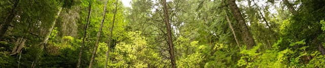
Data provides the official reported values detailing the evolution of forest area in post-communist Romania, spanning the years 1990 through 2019. This information, sourced directly from the Romanian National Statistics Institute, is published to clarify the actual changes in forestry surfaces following the end of communism. The underlying data segments surface areas as a total, per specific region and county, and by the type of forest (Woods, Softwood, Hardwood, Other).
Columns
- Category: Defines the classification of the forest terrain, such as Wood, Softwood, Hardwood, Other, or Total surfaces.
- Region: Specifies the geographical division, including individual counties (Judete), Macro-regions, and the national Total. Romania comprises 42 counties, including the capital city municipality, Bucharest (Bucuresti).
- Year: The specific year of the measurement or report, covering the range from 1990 to 2019.
- Unit: The standard unit used for all reported data, which is Thousands hectares.
- Value: The numerical surface area measured in Thousands hectares.
Distribution
The dataset is available as a CSV file (
forest_surfaces_romania_en_1990_2019.csv) and contains 5 distinct columns. The data structure includes 8111 valid entries, detailing measurements across the specified years.Usage
This data is ideal for clarifying whether forestry surfaces in Romania have been declining or increasing since 1990. Users can analyse trends to see exactly where surfaces increased or decreased at regional and county levels. It is highly suitable for statistical modelling, geographical mapping, and historical analysis related to environmental policy in Eastern Europe.
Coverage
Geographic Scope: Romania, covering all 42 counties, including Bucharest, and regional/macro-regional breakdowns.
Time Range: The 30-year period from 1990 to 2019.
Thematic Scope: Official forest surface area statistics, categorised by type (Woods, Softwood, Hardwood) and specific administrative boundaries.
License
CC0: Public Domain
Who Can Use It
- Environmental Researchers: To track long-term ecological changes and evaluate forest stability.
- Policy Analysts: To assess the long-term impact of post-communist land management policies.
- Geographers: For detailed spatial analysis and mapping of environmental resources within Europe.
Dataset Name Suggestions
- Post-Communist Romanian Forest Evolution (1990-2019)
- Forest Surfaces in Romania by County and Type (1990-2019)
- Official Romanian Forestry Data 1990-2019
Attributes
Original Data Source: Post-Communist Romanian Forest Evolution
Loading...