Dark Mode

British Columbia Urban Forestry Data
Data Science and Analytics
Tags and Keywords
Trusted By


"No reviews yet"
Free
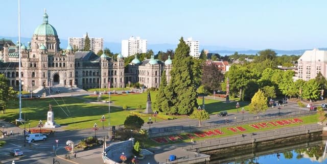
About
the location, species information, and metrics for over 33,000 planted trees situated within the vicinity of the city of Victoria, BC, Canada. The collection serves as an essential resource for geospatial mapping and sophisticated urban forestry analysis, offering robust attributes for Exploratory Data Analysis (EDA) across the city's green infrastructure.
Columns
- OBJECTID: A unique identifier for the row or record.
- X & Y: Coordinates used to plot the precise geographical location of the tree.
- SiteID: An identifying number for the tree site.
- Address: The numerical component of the street address.
- Street, OnStreet, FromStreet, ToStreet: Various textual descriptions related to the tree’s street location, highlighting street names like DALLAS RD or COOK ST.
- SideOfParcel: Indicates the tree's facing direction, with 'Front' being the most common value.
- Site: The site location number associated with the tree.
- Species, BotanicalName, CommonName: Different ways of identifying the tree species (e.g., Quercus garryana or Garry oak).
- DiameterAtBreastHeight: The measured diameter of the tree.
- GrowSpace: The type of growth area or category, frequently noted as 'Turf'.
- Trunks: The count of trunks the tree has.
- Height: The maximum current height of the tree.
- Width: The maximum current width of the tree.
- TreeCategory: Describes the placement type or use of the tree (e.g., 'Park Trees' or 'Boulevard Tree').
- Area & Parks: Identifies the placement area within Victoria (e.g., 'Fairfield' area) and the associated park name, if applicable (e.g., 'BEACON HILL PARK').
Distribution
The data is structured in a tabular format and is available as a CSV file named Tree_Species.csv, with a file size of 6.35 MB. It is composed of 22 distinct columns. The data includes approximately 33.8 thousand valid records. While the vast majority of records are valid, a handful of records (around 5) may contain missing values in certain metric and address fields.
Usage
This data is perfectly suited for several applications, including plotting tree coordinates on a map for visualisation purposes. It is useful for conducting geospatial analysis, allowing users to study spatial patterns. Furthermore, the detailed attributes enable thorough Exploratory Data Analysis (EDA) and clustering studies focused on urban vegetation characteristics.
Coverage
The geographic coverage is strictly limited to the city of Victoria, BC, Canada. The scope includes metrics and locations for all 33,000 or more planted trees currently within the city's jurisdiction. The data collection is performed using GPS location tracking by Parks Department staff. Data is routinely copied to VicMap and the Open Data Portal on a weekly basis, reflecting consistent maintenance.
License
CC0: Public Domain
Who Can Use It
The dataset is intended for use by urban ecologists, municipal city planners, geographic information systems (GIS) professionals, and researchers focused on urban tree canopy and biodiversity. It is also suitable for students or citizens undertaking projects involving local environmental monitoring or urban asset management.
Dataset Name Suggestions
- Victoria BC Urban Tree Species and Geospatial Metrics
- City of Victoria Planted Tree Inventory
- British Columbia Urban Forestry Data
- Victoria Municipal Tree Characteristics
Attributes
Original Data Source: British Columbia Urban Forestry Data
Loading...