Dark Mode

Road Condition Classification Images
Data Science and Analytics
Tags and Keywords
Trusted By


"No reviews yet"
Free
About
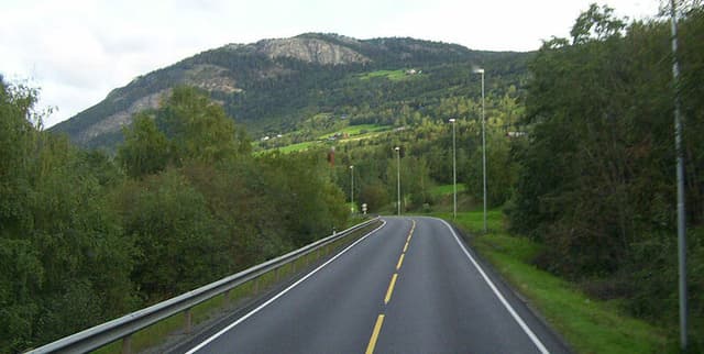
This dataset is designed for the classification of roads, determining whether they are clean or littered. It contains a collection of images depicting various road conditions, allowing for the development of models capable of distinguishing between clean and dirty environments. The primary aim is to facilitate the creation of an image classification model that can accurately identify littered sections of roads. Such a model can be instrumental in applications that automatically detect areas needing cleaning services through camera surveillance. The dataset consists of 237 images, which were gathered from the internet. Due to the limited size of the dataset, users may consider employing pre-trained models and data augmentation techniques to enhance model performance.
Columns
- filename: This column lists the names of the image files within the dataset. It contains 237 distinct values, all of which are valid.
- label: This column provides the class label for each image, indicating whether the road is clean (e.g., represented by 0) or littered (e.g., represented by 1). There are 113 images with labels between 0.00 and 0.10, and 124 images with labels between 0.90 and 1.00, reflecting the two distinct classes.
Distribution
The dataset is structured with an "Images" folder holding all the road images, accompanied by a
metadata.csv file. The metadata.csv file, which is approximately 3.83 kB in size, maps each image name to its corresponding class label. There are 237 individual images in total, and the metadata.csv file contains 2 columns and effectively 237 records, aligning with the number of images.Usage
This dataset is ideal for training and evaluating machine learning models focused on image classification, particularly for environmental monitoring and urban maintenance. It is well-suited for developing applications that can automatically detect road litter using camera feeds, enabling targeted dispatch of cleaning services. Researchers and developers can use this dataset to experiment with computer vision techniques, including deep learning and transfer learning, especially when dealing with smaller datasets.
Coverage
The dataset consists of images that were sourced from the internet, suggesting a varied, though unspecified, geographic origin. There is no specific time range or demographic scope attached to the images. The dataset contains 237 images, which might be considered a smaller collection for deep learning tasks, potentially necessitating the use of data augmentation methods to increase the effective size of the training data.
License
CC0: Public Domain
Who Can Use It
- Data Scientists and Machine Learning Engineers: To build and refine image classification models for environmental applications.
- Urban Planners and City Management: To develop tools for automated monitoring of urban cleanliness and resource allocation.
- Environmental Researchers: For studies on visual assessment of waste management and pollution.
- Students and Beginners in Computer Vision: As a practical dataset for learning image classification, deep learning, and transfer learning techniques.
Dataset Name Suggestions
- Road Condition Classification Images
- Urban Cleanliness Dataset
- Street Litter Image Classifier
- Environmental Road Scan Data
Attributes
Original Data Source: Road Condition Classification Images
Loading...