Dark Mode

Seismic Event Attributes Dataset
Data Science and Analytics
Tags and Keywords
Trusted By


"No reviews yet"
Free
About
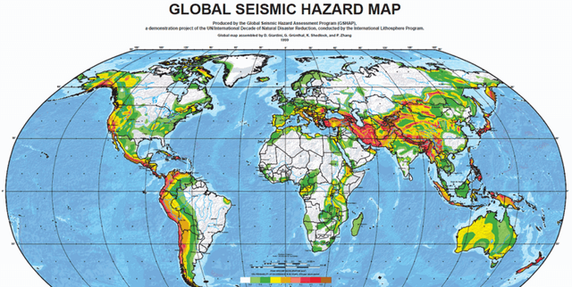
This dataset offers detailed information on 1,137 global earthquakes, providing a valuable resource for various analytical and scientific pursuits. It includes a wide array of attributes such as magnitude, precise location details, occurrence time, and diverse seismological measurements. The data was gathered using the EveryEarthquake API from RapidAPI, making it suitable for researchers, seismologists, and data enthusiasts engaged in analysis, machine learning initiatives, and geological investigations.
Columns
- id: A distinct identifier for each earthquake event.
- magnitude: The measured size or strength of the earthquake on the Richter scale.
- type: The classification of the seismic event (e.g., earthquake, explosion).
- title: A descriptive title for the earthquake event, typically including location and magnitude.
- date: The date when the earthquake took place.
- time: The time at which the earthquake occurred.
- updated: The timestamp indicating the last update for the event details.
- url: A web link to further details about the specific earthquake event.
- detailUrl: An additional URL for more in-depth information.
- felt: The reported number of individuals who experienced the earthquake.
- cdi: Community Determined Intensity, indicating how strongly the event was perceived.
- mmi: Modified Mercalli Intensity, a scale used to quantify the earthquake's effects.
- alert: The safety alert level issued for the earthquake (e.g., green, yellow, orange, red).
- status: The processing status of the event (e.g., reviewed, automatic).
- tsunami: A flag (0 or 1) indicating if the earthquake carried a tsunami risk.
- sig: The significance of the earthquake, determined by its magnitude and impact.
- net: The seismic network responsible for detecting the earthquake.
- code: A unique code assigned by the detecting network.
- ids: Identifiers of other related earthquake events.
- sources: The sources from which the event data was collected.
- types: Categories of event types linked to the earthquake.
- nst: The count of seismic stations that registered the event.
- dmin: The minimum distance to the earthquake event.
- rms: The root mean square of the signal, used to gauge earthquake intensity.
- gap: The data gap between the stations that detected the earthquake.
- magType: The specific type of magnitude measurement used (e.g., mb, Ms).
- geometryType: The geometric representation of the location, typically "Point".
- depth: The earthquake's hypocentre depth below the Earth's surface, in kilometres.
- latitude: The latitude coordinate of the earthquake's epicentre.
- longitude: The longitude coordinate of the earthquake's epicentre.
- place: A general textual description of the earthquake's geographical position.
- distanceKM: The distance in kilometres from the nearest populated area.
- placeOnly: A flag indicating if only place information is available.
- location: A full address or detailed description of the earthquake's location.
- continent: The continent where the earthquake occurred.
- country: The country where the earthquake occurred.
- subnational: The subnational region of the earthquake's occurrence.
- city: The city closest to the earthquake.
- locality: The locality or neighbourhood name.
- postcode: The postal code of the affected region.
- what3words: A unique 3-word code representing the location.
- timezone: The timezone relevant to the earthquake's occurrence.
- locationDetails: Extra details regarding the earthquake’s location.
Distribution
The dataset comprises 1,137 earthquake events, each described by 43 distinct attributes. It is typically provided as a CSV file, with a sample file of earthquakes.csv being 1.84 MB. Specific row or record numbers are available, indicating the scope of the data.
Usage
This dataset is ideal for:
- Analysing patterns in seismic activity across the globe.
- Developing machine learning models for earthquake prediction or classification.
- Investigating the connections between earthquake characteristics and geographical features.
- Creating visualisations and maps of seismic events.
- Studying the impact of earthquakes on various regions and localities.
- Academic research purposes.
- Practical risk assessment and emergency planning.
Coverage
The dataset covers global earthquake events. It provides detailed location information, spanning from continent down to locality level. The time range for the included events is from 23 June 2023 to 18 September 2024. The dataset does not explicitly focus on demographic scope. Some location attributes, such as continent, country, subnational, city, and postcode, may have missing values for certain events. Similarly, the alert level attribute also contains some missing data.
License
CC BY-SA 4.0
Who Can Use It
This dataset is intended for:
- Researchers: For in-depth academic studies and scientific inquiries into seismic activity.
- Seismologists: To analyse earthquake phenomena and understand geological processes.
- Data Enthusiasts: For personal projects, exploration, and learning about earth sciences.
- Data Scientists: To build and train machine learning models for prediction and classification.
- Geologists: To study the relationship between earthquake characteristics and geological features.
- Disaster Preparedness Experts: For risk assessment, emergency planning, and impact analysis.
Dataset Name Suggestions
- Global Earthquake Activity Records
- Worldwide Seismic Event Data
- Earthquake Analysis Resource
- Seismic Event Attributes Dataset
- Planetary Tremor Log
Attributes
Original Data Source: Seismic Event Attributes Dataset
Loading...