Dark Mode

Historical Motor Vehicle Collisions in NYC
Data Science and Analytics
Tags and Keywords
Trusted By


"No reviews yet"
Free
About
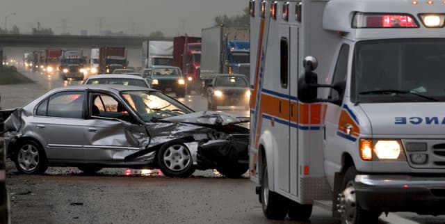
Detailed records of motor vehicle collisions reported by the New York Police Department (NYPD) are provided, with each row representing a unique crash event. This information is sourced from police reports of all motor vehicle collisions within New York City, offering valuable insights for urban planning, traffic safety analysis, and data-driven policy-making. The data was originally made available through Data.gov, the United States government's open data portal.
Columns
- CRASH DATE: The specific date of the collision.
- CRASH TIME: The time when the collision occurred.
- BOROUGH: The New York City borough where the collision took place.
- ZIP CODE: The postal code for the collision location.
- LATITUDE: The latitudinal coordinate of the collision.
- LONGITUDE: The longitudinal coordinate of the collision.
- LOCATION: The combined map coordinates (latitude, longitude) of the collision.
- ON STREET NAME: The name of the street where the crash occurred.
- CROSS STREET NAME: The name of the nearest cross street to the crash location.
- OFF STREET NAME: The name of the street if the collision occurred off the main roadway.
- NUMBER OF PERSONS INJURED: Total count of individuals injured in the crash.
- NUMBER OF PERSONS KILLED: Total count of individuals killed in the crash.
- NUMBER OF PEDESTRIANS INJURED: The number of pedestrians who were injured.
- NUMBER OF PEDESTRIANS KILLED: The number of pedestrians who were killed.
- NUMBER OF CYCLIST INJURED: The number of cyclists who were injured.
- NUMBER OF CYCLIST KILLED: The number of cyclists who were killed.
- NUMBER OF MOTORIST INJURED: The number of motorists who were injured.
- NUMBER OF MOTORIST KILLED: The number of motorists who were killed.
- CONTRIBUTING FACTOR VEHICLE 1: The primary contributing factor for the first vehicle involved.
- CONTRIBUTING FACTOR VEHICLE 2: The primary contributing factor for the second vehicle involved.
- CONTRIBUTING FACTOR VEHICLE 3: The primary contributing factor for the third vehicle involved.
- CONTRIBUTING FACTOR VEHICLE 4: The primary contributing factor for the fourth vehicle involved.
- CONTRIBUTING FACTOR VEHICLE 5: The primary contributing factor for the fifth vehicle involved.
- COLLISION_ID: A unique identifier for each collision event.
- VEHICLE TYPE CODE 1: The type of the first vehicle involved (e.g., Sedan).
- VEHICLE TYPE CODE 2: The type of the second vehicle involved.
- VEHICLE TYPE CODE 3: The type of the third vehicle involved.
- VEHICLE TYPE CODE 4: The type of the fourth vehicle involved.
- VEHICLE TYPE CODE 5: The type of the fifth vehicle involved.
Distribution
- Format: CSV
- File Size: 432.44 MB
- Structure: The data consists of 29 columns and contains approximately 2.03 million rows, with each row representing a distinct collision event.
Usage
This data is ideal for performing exploratory data analysis and creating data visualisations to understand traffic incident patterns. It can be used to identify high-risk areas, analyse the causes of accidents, and evaluate the effectiveness of road safety measures over time. Urban planners can use it to design safer streets, and insurance companies can leverage it for risk modelling.
Coverage
- Geographic: The data covers all police-reported motor vehicle collisions within the boroughs of New York City, United States.
- Time Range: The dataset includes records from 1 July 2012 to 13 October 2023.
- Data Availability: Some columns, such as BOROUGH, ZIP CODE, and location data (LATITUDE, LONGITUDE), have a notable percentage of missing values. Information on contributing factors and vehicle types becomes increasingly sparse for collisions involving more than two vehicles.
License
CC0: Public Domain
Who Can Use It
- Urban Planners: To analyse accident hotspots and inform infrastructure improvements.
- Data Scientists: For predictive modelling of collision frequency and severity.
- Public Safety Officials: To develop and assess targeted traffic safety campaigns.
- Journalists: For investigative reporting on urban transport safety trends.
- Researchers: To study the long-term patterns and contributing factors of vehicle accidents in a major metropolitan area.
Dataset Name Suggestions
- NYC Motor Vehicle Collision Records
- New York City Traffic Accident Data
- NYPD Collision Event Data (2012-2023)
- NYC Crash Data and Vehicle Information
- Historical Motor Vehicle Collisions in NYC
Attributes
Original Data Source: Historical Motor Vehicle Collisions in NYC
Loading...