Dark Mode

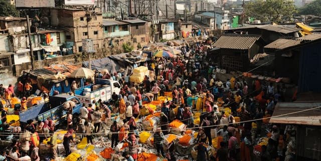
World Urban Population Density List
Data Science and Analytics
Tags and Keywords
Trusted By


"No reviews yet"
Free
About
A listing of cities across the globe, categorised by their population density. The data specifically focuses on the city proper, referring to the defined boundary, border, or city limits, rather than the wider metropolitan or urban area, or individual districts within cities. It includes figures for population, population density (per square kilometre and per square mile), and the land area of each city listed. The population density is calculated as the average number of people residing per square kilometre or square mile.
Columns
- Index Number: An identifier for each entry. Values range from 0 to 49.
- City: The name of the city. There are 50 unique city names.
- Population: The population count for each city. There are 50 unique population figures provided (e.g., 153,904).
- Area (km²): The land area of the city in square kilometres. There are 50 unique area figures (e.g., 1.956).
- Area (mi²): The land area of the city in square miles. There are 49 unique area figures (e.g., 19.98).
- Density (/km²): The population density expressed as people per square kilometre. Values range from approximately 15,700 to 78,700.
- Density (/mi²): The population density expressed as people per square mile. Values range from approximately 53.6 to 204,000.
- Country: The name of the country where the city is located. There are 14 unique country names, with India and the Philippines being the most frequent.
Distribution
The dataset is provided as a CSV file, specifically named "List of world cities by population density.csv", with a file size of 3.18 kB. It is structured as tabular data with 8 columns and contains 50 distinct records or rows, all of which are valid. The dataset is expected to be updated annually.
Usage
This dataset is ideal for data analytics and data visualisation projects focused on urban studies and demographics. It can be utilised for:
- Comparing population densities across various global cities.
- Analysing urbanisation trends based on city proper definitions.
- Developing visual representations of global urban density.
- Supporting research in social sciences related to urban planning and geography.
Coverage
The dataset covers a selection of cities worldwide. It provides geographic scope across various countries, with a notable presence of cities from India and the Philippines. The data specifically relates to the city proper boundaries and does not extend to metropolitan or urban areas. The temporal scope implies a current snapshot, with an expected annual update frequency. There are no specific notes on data availability for particular demographic groups, as the focus is on aggregate city population and area.
License
CC0: Public Domain
Who Can Use It
This dataset is suitable for a wide range of users, including:
- Urban planners and policymakers for city development and resource allocation studies.
- Researchers and academics in fields such as geography, demography, and social sciences.
- Data analysts and scientists for exploratory data analysis and model building.
- Students undertaking projects related to global urbanisation and population studies.
- Journalists and media professionals for reporting on urban trends and population statistics.
Dataset Name Suggestions
- Global City Density Data
- World Urban Population Density List
- City Proper Density Worldwide
- International City Population Metrics
Attributes
Original Data Source: World Urban Population Density List
Loading...