Dark Mode

Marmara Region Fault Dynamics Records
Data Science and Analytics
Tags and Keywords
Trusted By


"No reviews yet"
Free
About
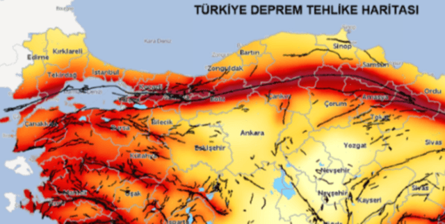
offers a detailed collection of seismic activity and corresponding fault line characteristics within the Marmara Region of Turkey, covering the period between 2000 and 2025. It integrates specific earthquake records—including location coordinates, depth, time, and magnitude—with geophysical details of the proximal fault zones. These details incorporate fault type, physical dimensions (length, width, depth), slip rate, recurrence intervals, moment potential, and elapsed time since the last significant event. The primary purpose of this resource is to facilitate the modelling of earthquake behaviour using advanced geophysical and spatial analysis techniques.
Columns
The dataset contains 23 fields designed to capture both the seismic event and the geological context:
- Date: The date the earthquake occurred.
- Latitude: Latitude of the earthquake epicentre.
- Longitude: Longitude of the earthquake epicentre.
- Depth_km: Earthquake depth in kilometers (ranging from 0.71 to 83.1 km).
- Magnitude_ML: Local magnitude of the earthquake (ranging from 2.0 to 6.2).
- Location: Textual description of the location (nearest town or district).
- Nearest_Fault: Name of the closest fault line, identified via spatial matching (e.g., Orhaneli Fayı, Kuzey Anadolu Fay Zonu).
- Fault_Length_km: Estimated length of the matched fault in kilometers.
- Fault_Width_m: Estimated width of the fault trench in meters.
- Fault_Depth_m: Estimated depth of the fault trench in meters.
- Fault_Type: Classification of the fault (e.g., strike-slip, normal, strike-slip + thrust).
- Length_km: Approximate surface length of each fault segment in kilometers.
- Seismogenic_Depth_km: Depth of the fault capable of producing earthquakes.
- Slip_Rate_mm_per_yr: Average horizontal or vertical slip rate in millimetres per year.
- Max_Surface_Slip_m: Maximum observed slip on the fault surface in meters.
- Recurrence_Interval_yr: Estimated average time between large earthquakes (ranging from 250 to 750 years).
- Last_Event_Year: Year of the last known surface-breaking earthquake (historical range from 1650 to 2008).
- Last_Event_Mw: Moment magnitude of the last event.
- Elapsed_Time_yr: Years passed since the last major event (up to 375 years).
- Slip_Deficit_m: Estimated slip deficit based on time and slip rate.
- Normalized_Slip_m_per_km: Normalized slip per kilometre of fault length (m/km).
- Moment_Potential_Nm: Earthquake energy potential (moment) in Newton-meters.
- Mw_Potential: Theoretical maximum moment magnitude potential.
Distribution
The data is structured as a tabular file, typically provided in CSV format. It contains 21.6k validated records. The data spans a time series from 23 April 2000 to 23 April 2025. All fields show 100% validity, with no missing or mismatched records reported in the sample analysis. The size of the file is approximately 5.2 MB.
Usage
This data is highly valuable for developing sophisticated models and conducting in-depth analyses, supporting:
- Time-series forecasting related to seismic events.
- Geospatial analysis focusing on fault-earthquake interactions.
- Machine learning applications for geophysical risk modelling.
- Studies aimed at understanding and predicting earthquake behaviour based on physical fault features.
Coverage
The data focuses exclusively on the Marmara Region of Turkey. The geographical scope encompasses latitudes primarily between 39.5 and 41.5, and longitudes between 26.0 and 30.5. The temporal scope covers seismic and geological observations collected over 25 years, specifically 2000 through 2025. This allows for detailed analysis of recent seismic activity trends and long-term fault dynamics.
License
Attribution-NonCommercial 4.0 International (CC BY-NC 4.0)
Who Can Use It
The primary intended users include:
- Researchers: To study plate tectonics, seismic hazard assessment, and geological modelling.
- Data Scientists: To build predictive models for geophysical features and risk assessment.
- Students: To analyse real-world seismic data for academic projects in Earth sciences and data analytics.
Dataset Name Suggestions
- Marmara Fault-Earthquake Interactions (2000–2025)
- Seismological and Geospatial Data of Marmara Faults and Earthquakes
- Turkish Geophysical Seismic Hazard Data
- Marmara Region Fault Dynamics Records
Attributes
Original Data Source: Marmara Region Fault Dynamics Records
Loading...