Dark Mode

Futuristic Urban Transport Simulation Data
Data Science and Analytics
Tags and Keywords
Trusted By


"No reviews yet"
Free
About
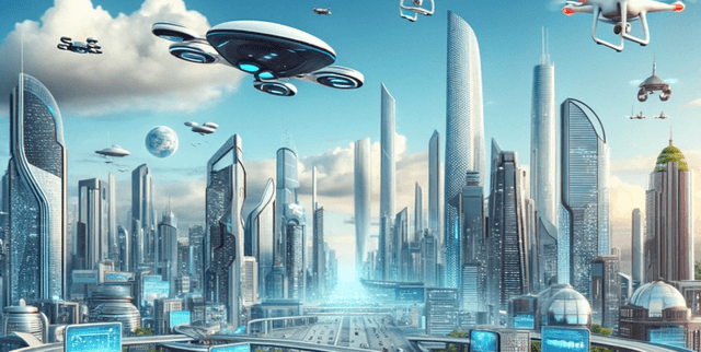
A detailed look at traffic conditions within fictional, technologically advanced urban environments. It focuses on decoding urban motion and analyzing traffic density across six distinct cities of tomorrow. This simulated resource captures the various physical and economic factors that influence traffic flow and estimated energy usage in a future smart city context.
Columns
- City: The name of the specific fictional urban area (e.g., MetropolisX, SolarisVille, Ecoopolis, AquaCity).
- Vehicle Type: The mode of transport recorded, which includes future vehicle types such as Flying Car, Drone, Autonomous Vehicle, and standard Car.
- Weather Conditions: The current atmospheric status at the time of data capture (e.g., Clear, Rainy, Solar Flare, Snowy).
- Economic Conditions: The state of the city's economy when the record was created (e.g., Booming or Recession).
- Day of Week: The specific day of the week.
- Hour of Day: The recorded time slot during which the data observation occurred.
- Speed: The recorded velocity of the vehicle, which ranges from approximately 6.69 to 163 units.
- Energy Consumption: An estimate of energy usage calculated based on the recorded speed and the vehicle type (ranging from approximately 4.93 to 190 units).
- Is Peak Hour: A binary indicator showing whether the observation was captured during peak traffic times.
- Random Event Occurred: A binary indicator detailing whether an unexpected event (such as an accident or road closure) took place.
- Traffic Density: The measured density of traffic at the time of recording, with values between 0.01 and 3.38.
Distribution
The dataset includes over 1.2 million individual records, consisting of 11 distinct attributes per record. The data is provided in a standard CSV file format. Detailed analysis shows high data quality, with zero mismatched or missing values recorded across any of the columns. The file size is approximately 100 MB.
Usage
The data is highly suitable for developing and rigorously testing advanced traffic management algorithms, especially those required for autonomous vehicle operation and smart city infrastructure. It facilitates sophisticated analysis of how external variables like weather and economic climates affect overall traffic flow and associated vehicle energy usage. It is a simulated resource intended for academic study and analytical modelling.
Coverage
Geographic coverage is centered on six distinct, fictional cities, where the majority of observations are distributed across locations like Ecoopolis and AquaCity. The temporal scope covers all seven days of the week and all 24 hours of the day. The observations incorporate diverse vehicle types representative of a futuristic environment, with Autonomous Vehicles being the most frequently recorded type.
License
CC BY-SA 4.0
Who Can Use It
- Urban Planners: To run simulations and optimize futuristic city layouts to alleviate congestion and improve flow dynamics.
- Data Scientists and Machine Learning Engineers: For building predictive models focused on calculating speed, energy demand, or forecasting future traffic density levels.
- Academic Researchers: For conducting scientific studies on the interdependencies between urban infrastructure, vehicle technology, and environmental impact.
Dataset Name Suggestions
- FutureFlow: Navigating Tomorrow's Urban Traffic
- Futuristic Urban Transport Simulation Data
- Smart City Traffic Dynamics Record
- Vehicle Energy Consumption & Flow Model
Attributes
Original Data Source: Futuristic Urban Transport Simulation Data
Loading...