Dark Mode

Agriculture Area Harvested and Production Data
Data Science and Analytics
Tags and Keywords
Trusted By


"No reviews yet"
Free
About
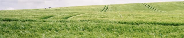
This statistical resource provides essential data for global agricultural analysis and monitoring efforts concerning food security. The data is instrumental for policy makers aiming to understand the patterns, forms, and scope of hunger and malnutrition worldwide, serving as a basis for planning and measuring progress. The resource records agricultural statistics for 173 products, spanning categories such as Cereals, Pulses, Fruit, Vegetables and Melons, Oil crops, and Roots and Tubers. Data is primarily expressed in terms of the area harvested, the total quantity of production, and the corresponding yield. Note that area data specifically relates to harvested area, excluding crops used for hay, silage, or grazing.
Columns
- Area Code: A numerical identifier for the country or region.
- Country Name: The name of the specific country or geographical aggregate.
- Item Code: A unique integer identifier for the product or crop.
- Item: The name of the product or crop, such as 'Vegetables Primary' or 'Roots and Tubers'.
- Element Code: A numerical code classifying the type of agricultural data element (e.g., Area harvested, Yield, or Production Quantity).
- Element: The textual description of the statistical measure being recorded ('Area harvested', 'Yield', or 'Production').
- Year Code: The integer code representing the year of data collection.
- Year: The calendar year in which the harvest began.
- Unit: The measurement unit for the corresponding value, such as 'tonnes' or 'ha'.
- Value: The numerical quantity corresponding to the Area harvested, Yield, or Production.
- Flag: An indicator detailing how the data was sourced or obtained.
Distribution
The data is provided in a large tabular format, specifically within the
Crops_AllData_Normalized.csv file, which is approximately 262.33 MB in size. The dataset contains 11 distinct columns. The primary file holds over 2.5 million records of crop statistics. Updates to this dataset are expected to occur quarterly.Usage
This data product is suited for a wide range of analytical applications, including:
- Informing national and international agricultural policy decisions.
- Performing time-series analysis on global food supply trends, area cultivation, and productivity changes.
- Providing foundational statistics for research projects focused on specific crop dynamics, such as determining the popularity of crops in particular regions.
- Developing visualisations and models to track historical changes in yield and production output.
Coverage
The dataset covers agricultural statistics for all countries globally, aligned with the geographical aggregates defined by the United Nations M-49 list. The temporal scope ranges from 1961 up to 2018, though certain calculated elements (like seed data) may extend only to 2017. The data covers 173 different primary crop products. Area under cultivation refers to the total sown area, minus any areas ruined by events like natural disasters.
License
Attribution 3.0 IGO (CC BY 3.0 IGO)
Who Can Use It
- Agricultural Economists: To model market impact and forecast future production scarcity or surplus.
- Government Analysts: To benchmark national crop performance against global or regional averages.
- Academic Researchers: To conduct historical studies on land use and crop yield advancements.
- Data Scientists: For developing predictive models related to food security or climate change impact on agriculture.
Dataset Name Suggestions
FAO Global Crop Production and Yield Statistics
Historical World Crop Data (1961–2018)
Agriculture Area Harvested and Production Data
UN Crop Statistics Database
Attributes
Original Data Source: Agriculture Area Harvested and Production Data
Loading...