

Drone Park Vehicle Congestion Dataset
Computer Vision & Video Datasets
Tags and Keywords

£8,000
About
Overview
Description
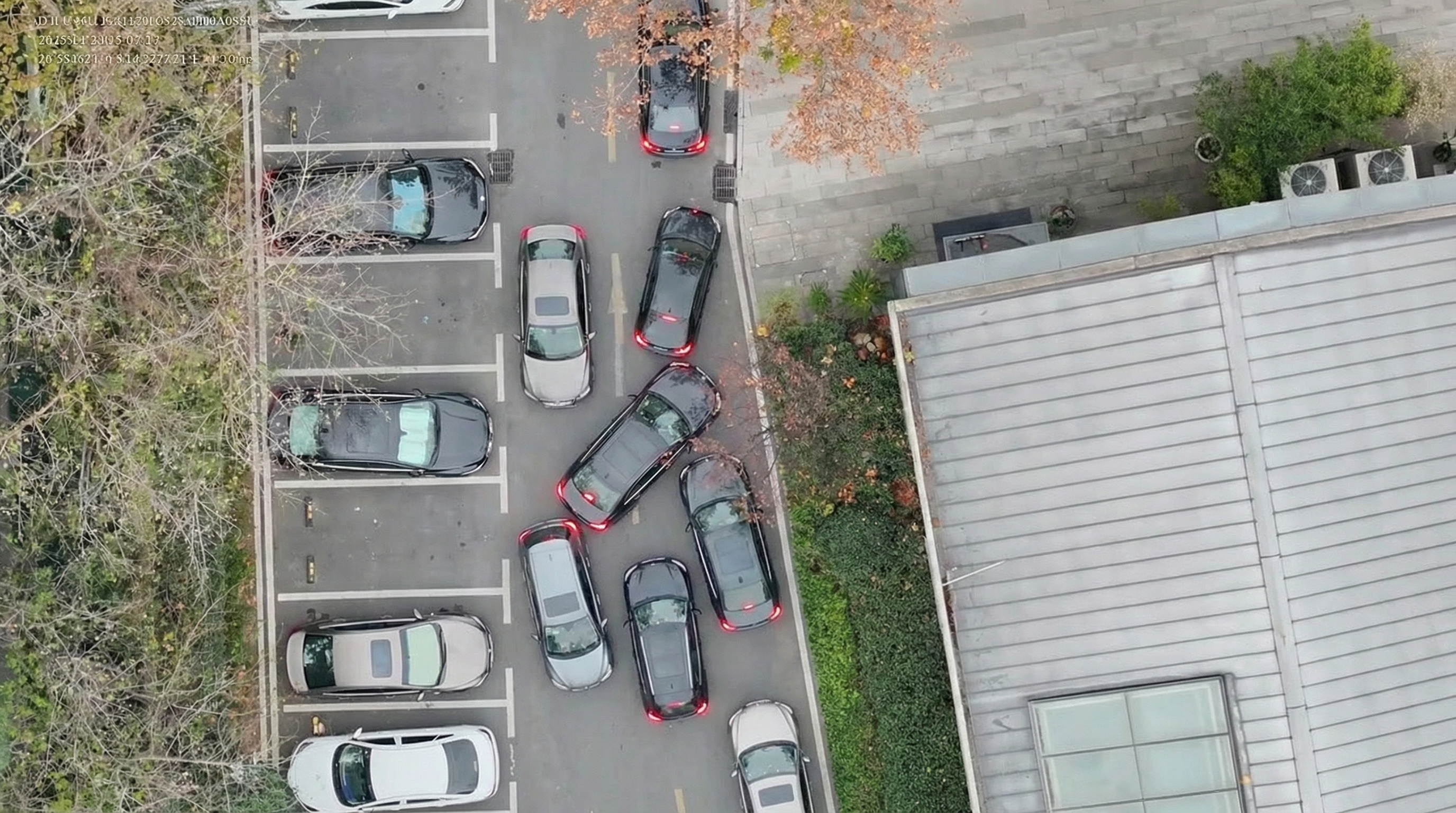
This dataset was collected from industrial parks using industrial-grade unmanned aerial vehicles from high-altitude, top-down perspectives. It focuses on vehicle congestion detection, vehicle counting, and traffic flow analysis in park roads, large office districts, and logistics-related environments. The data covers outdoor daytime scenes under natural lighting conditions and captures vehicle distribution, parking or queuing states, and congestion patterns from an aerial view. It is suitable for Intelligent Transportation Systems, Smart City applications, park traffic monitoring, vehicle queue warning, smart parking guidance, and violation assistance recognition. The dataset includes annotated vehicle targets and can support model training for vehicle detection, congestion analysis, and UAV-based traffic surveillance.
Keywords
Drone vision, Industrial park traffic, Congestion detection, Vehicle counting, Intelligent transportation, Uav surveillance
Industry and Use Cases
- Smart City
- Intelligent Transportation Systems
- Industrial Park Traffic Monitoring
- Violation Assistance Recognition
Data Specification
Content and Scale
- Record unit: images
- Total records: 20,000 images
- Total data volume: 30 GB
Technical Specification
- Primary media format: JPEG
- Resolution: 1920 x 1080 px
- Color space: RGB
Annotation
- Annotation status: fully_annotated
- Label categories / entities: vehicle
- Annotation format: COCO JSON
Coverage
- Diversity / distribution: industrial park road scenes, vehicle distribution, parking or queuing states, traffic flow density
Sample Media



License, Delivery
Commercial use and AI model training are supported.
Listing Stats
VIEWS
1
DELIVERY
SPECIFIED IN DESCRIPTION
LISTED
16/09/2026
UPDATED
17/09/2026
REGION
GLOBAL
 TRUST
TRUST
5 / 5
Loading...
£8,000
Download Dataset in IMAGE Format
Recommended Datasets
Loading recommendations...