Dark Mode

Historical Utah Drought Severity Data
Data Science and Analytics
Tags and Keywords
Trusted By


"No reviews yet"
Free
About
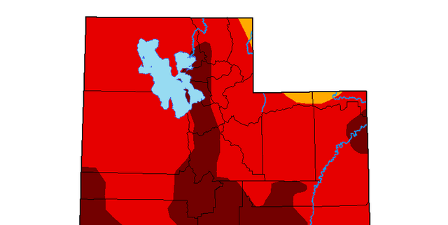
Historical measurements detail the severity of drought and wetness conditions across the state of Utah, extending backward in time for 2000 years. This long-term data repository was sourced from government monitoring efforts, driven by current requirements for robust water conservation programmes. The collection allows for the examination of climate history and provides essential context for water resource modelling.
Columns
- SCORE: A calculated measure ranging from 0 to 100, indicating the overall balance of wetness versus dryness. This value is derived using the formula 100 minus the combined percentages of Abnormally Dry (D0) and Abnormally Wet (W0) conditions.
- DATE: Represents the year number for which the observations were recorded.
- D0: The percentage of area categorised as Abnormally Dry.
- D1: The percentage of area experiencing Moderate Drought.
- D2: The percentage of area experiencing Severe Drought.
- D3: The percentage of area experiencing Extreme Drought.
- D4: The percentage of area experiencing Exceptional Drought.
- NA_COUNT: The percentage of missing or Not Available data for a given year.
- W0: The percentage of area categorised as Abnormally Wet.
- W1: The percentage of area experiencing Moderate Wet conditions.
- W2: The percentage of area experiencing Severe Wet conditions.
- W3: The percentage of area experiencing Extreme Wet conditions.
- W4: The percentage of area experiencing Exceptional Wet conditions.
Distribution
The data is delivered in a tabular structure, typically in a CSV file format, such as
0-2017-yearly.csv. The structure includes 13 distinct columns. The data is managed with an expected update frequency of annually. Validation of the records indicates high data quality, with 2018 records being fully valid.Usage
This resource is perfectly suited for time series analysis, enabling users to model long-term climatic fluctuations and understand multi-century patterns of water availability. Key applications include supporting research into sustainable water management and conservation policies, agricultural risk analysis, and studies focused on the long-term impact of climatic shifts.
Coverage
The geographical focus of the data is strictly limited to the state of Utah. The temporal extent is vast, beginning at year 0 and continuing up to 2017, providing a continuous annual record spanning two millennia.
License
CC0: Public Domain
Who Can Use It
- Policy Makers: To establish effective long-range planning for water infrastructure and resource allocation based on historical climate risk.
- Academic Researchers: For deep analysis of palaeoclimate data and historical severity indexing.
- Environmental Consultants: To assess vulnerability to severe drought events in Utah.
- Agricultural Engineers: For optimising regional farming practices against predicted dryness or wetness trends.
Dataset Name Suggestions
- Utah State Two-Millennium Climate Record
- Historical Utah Drought Severity Data (Drought.gov)
- Utah Annual Wetness and Dryness Index
- 2000 Years of Utah Climate Monitoring
Attributes
Original Data Source: Historical Utah Drought Severity Data
Loading...