Dark Mode

Wildfire Affected Buildings California
Data Science and Analytics
Tags and Keywords
Trusted By


"No reviews yet"
Free
About
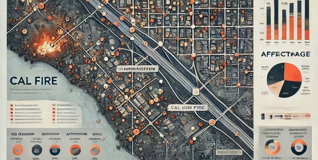
Damage sustained by structures across various wildland fire incidents in California. Damage is categorised by percentage, ranging from minor (1-10%) to complete destruction (50-100%). Field inspectors evaluate structures impacted by these fires to collect this vital information. This data product is invaluable for fire prevention, emergency response, and disaster management initiatives. It is provided by the California Department of Forestry and Fire Protection (CAL FIRE) in collaboration with the National Interagency Fire Center (NIFC) and the Fire Integrated Real-Time Intelligence System (FIRIS). Data is gathered through satellites and aerial infrared platforms, processed in near-real-time for fire perimeter modelling by WIFIRE, and integrated for decision support via Intterra's software.
Columns
- OBJECTID: A unique identifier for each record in the dataset.
- DAMAGE: Indicates the level of fire damage to the structure (e.g., "No Damage", "Affected (1-9%)").
- STREETNUMBER: The street number of the impacted structure.
- STREETNAME: The name of the street where the impacted structure is located.
- STREETTYPE: The type of street (e.g., "Road", "Lane").
- STREETSUFFIX: Additional address information, such as apartment or building numbers (if applicable).
- CITY: The city where the impacted structure is located.
- STATE: The state abbreviation (e.g., "CA" for California).
- ZIPCODE: The postal code of the impacted structure.
- CALFIREUNIT: The CAL FIRE unit responsible for the area.
- COUNTY: The county where the impacted structure is located.
- COMMUNITY: The community or neighbourhood of the structure.
- INCIDENTNAME: The name of the fire incident that impacted the structure.
- APN: The Assessor’s Parcel Number (APN) of the property.
- ASSESSEDIMPROVEDVALUE: The assessed value of the improved property (e.g., structures, not just land).
- YEARBUILT: The year the structure was built.
- SITEADDRESS: The full address of the property, including city, state, and ZIP code.
- GLOBALID: A globally unique identifier for each record.
- Latitude: The latitude coordinate of the structure’s location.
- Longitude: The longitude coordinate of the structure’s location.
- UTILITYMISCSTRUCTUREDISTANCE: The distance between the main structure and any utility or miscellaneous structures (if recorded).
- FIRENAME: An alternative or secondary name for the fire incident.
- geometry: A geospatial representation of the location in a point format (e.g., "POINT (-13585927.697 4646740.750)"), suitable for mapping applications and visualisation.
Distribution
The dataset is provided in
.geojson format, specifically as POSTFIRE_MASTER_DATA_SHARE_140463065990229786.geojson, with a file size of 134.68 MB. It is structured as a FeatureCollection. Previews may be truncated due to the file's large size, meaning the full content of JSON items and individual features might not be visible without downloading or using a notebook environment. The expected update frequency for this dataset is "Never".Usage
This dataset is ideally suited for applications in fire prevention planning, optimising emergency response strategies, and refining disaster management efforts. It supports various analytical and visualisation tasks related to fire-affected structures, including geospatial analysis and data visualisation. It can inform research and decision-making, though independent verification of the data and its derivation is advised.
Coverage
The dataset's geographic scope is limited to California, focusing on structures impacted by wildland fires within the state. It reflects damage across various fire incidents. There is no specific time range mentioned for the collection of this structures-specific data, but it pertains to past fire incidents. Some columns, such as
UTILITYMISCSTRUCTUREDISTANCE, may contain missing values where information could not be determined during data collection.License
Creative Commons Attribution 4.0 International (CC BY 4.0)
Who Can Use It
This dataset is intended for a range of users including fire prevention specialists, emergency response teams, disaster management professionals, and government agencies involved in land management and public safety. Researchers and data analysts can also utilise this data for studies on wildfire impact, urban planning in fire-prone areas, and geospatial analysis. Anyone requiring insights into structures affected by wildland fires in California will find this data valuable.
Dataset Name Suggestions
- California Wildfire Structure Damage Data
- CAL FIRE Wildland Fire Impacted Structures
- California Structures Fire Damage Assessment
- Wildfire Affected Buildings California
- California Fire Incident Structure Loss
Attributes
Original Data Source: Wildfire Affected Buildings California
Loading...