Dark Mode

Bangalore Traffic Patterns Dataset
Data Science and Analytics
Tags and Keywords
Trusted By


"No reviews yet"
Free
About
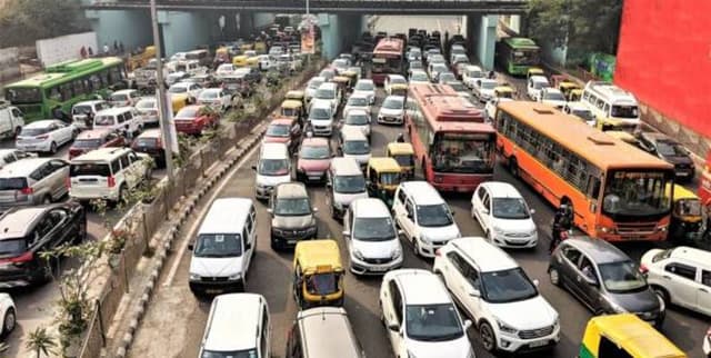
Captures detailed traffic patterns across major roads and intersections in Bangalore, offering insights into urban congestion and commuter behaviour. It includes metrics such as traffic volume, speed, congestion levels, and environmental impact, providing a detailed view of the city's transportation dynamics.
Columns
- Date: The date of the traffic observation.
- Area Name: The name of the area in Bangalore (e.g., Indiranagar, M.G. Road).
- Road/Intersection Name: Specific location identifier for the observation (e.g., 100 Feet Road).
- Traffic Volume: The count of vehicles passing a specific location.
- Average Speed: The average speed of traffic at the location.
- Travel Time Index: A measure of time deviation from the norm.
- Congestion Level: A measure of traffic density.
- Road Capacity Utilization: The percentage of road usage.
- Incident Reports: The number of traffic-related incidents.
- Environmental Impact: Data on emissions and pollution.
- Public Transport Usage: The volume of public transport use.
- Traffic Signal Compliance: The rate of adherence to traffic signals.
- Parking Usage: The occupancy rate of parking spaces.
- Pedestrian and Cyclist Count: The count of non-motorised road users.
- Weather Conditions: Weather observed during the data collection (e.g., Clear, Overcast).
- Roadwork and Construction Activity: Status of ongoing construction.
Distribution
The dataset is provided as a single CSV file,
Banglore_traffic_Dataset.csv, with a size of 1.54 MB. It contains 8,936 rows and 16 columns, with no missing values.Usage
Ideal for data analytics, data visualisation, and statistical analysis, including techniques like K-Means clustering. This dataset can be used to understand urban traffic dynamics, plan smart city applications, and analyse commuter behaviour.
Coverage
- Geographic: Covers major roads and intersections in Bangalore, India, including areas like Indiranagar and M.G. Road.
- Time Range: The data spans from 1st January 2022 to 9th August 2024.
License
CC0: Public Domain
Who Can Use It
- Urban Planners: For analysing city transportation dynamics and improving infrastructure.
- Data Scientists: For building predictive models for traffic flow and congestion.
- Smart City Developers: For creating applications that provide real-time traffic insights.
- Researchers: For studying commuter behaviour and the environmental impact of urban traffic.
Dataset Name Suggestions
- Bangalore Urban Traffic Dynamics
- Bangalore Commuter and Congestion Data
- Urban Mobility Insights: Bangalore
- Bangalore Traffic Patterns Dataset
Attributes
Original Data Source: Bangalore Traffic Patterns Dataset
Loading...