Dark Mode

India States & Union Territories Administrative and Demographic Data
Government & Civic Records
Tags and Keywords
Trusted By


"No reviews yet"
Free
About
An expansive overview of India’s States and Union Territories, detailing their administrative structures, demographic characteristics, and rich linguistic variety. This resource offers essential insights into the vastness and complexity of regional distribution across India, combining vital information on governance, geography, population metrics, and language diversity, updated on a daily basis.
Columns
- Name: The official name of the State or Union Territory.
- Type: The administrative classification, indicating whether the region is a State or a Union Territory.
- ISO: The officially designated ISO Code.
- Vehicle Code: The unique vehicle registration code assigned to the region.
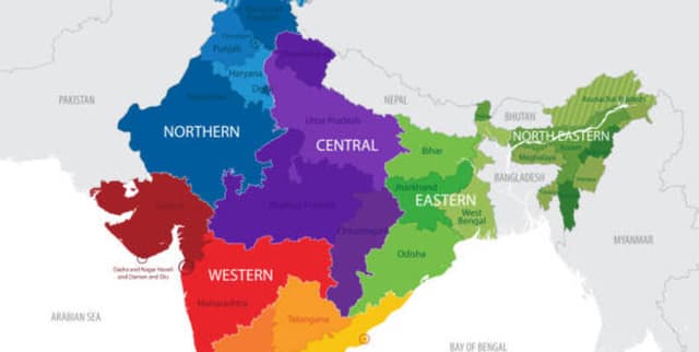
- Zone: The geographical zone of India in which the region is situated.
- Capital: The administrative capital city.
- Largest City: The city within the region that holds the largest population count.
- Statehood: The year when the State achieved its full statehood status.
- Population: The total population count of the State or Union Territory, ranging from a minimum of 64.5 thousand to a maximum of 200 million.
- Area (sq. km): The geographical area measured in square kilometers, spanning from 32 sq. km to 342 thousand sq. km.
- Official Languages: The primary official language(s) of the State or Union Territory (Hindi is the most common).
- Additional Official Languages: Any secondary official languages used across the region.
Distribution
The data file, named
states_and_ut.csv, is delivered in CSV format and is approximately 4.15 kB in size. It contains 12 columns in total. The dataset includes information on 36 unique entities (States and UTs). Population data has a calculated mean of approximately 33.6 million, and the Area data has a mean of 88 thousand square kilometers. The dataset is expected to be updated daily.Usage
- Conducting Data Analysis to understand regional distribution and demographic patterns.
- Supporting Geography Research by exploring geographical zones and area measurements.
- Facilitating Linguistic Studies to analyse the variety and richness of languages spoken across India.
- Enabling Governance Comparison between States and Union Territories based on their type and the year they achieved statehood.
Coverage
The data covers all 36 States and Union Territories of India, encompassing their geographic zones, administrative capitals, and largest cities. The time range for statehood dates spans from 26 January 1950 through to 26 January 2020. Coverage includes detailed demographic data, such as total population figures, and detailed linguistic information, including both primary and secondary official languages.
License
CC0: Public Domain
Who Can Use It
- Researchers and data analysts requiring detailed, up-to-date regional data for statistical modeling.
- Students engaged in social science, governance, or geographical studies focused on the Indian subcontinent.
- Application developers who need reliable administrative boundaries and demographic information.
- Individuals interested in comparing regional governance structures and population dynamics across India.
Dataset Name Suggestions
- India States & Union Territories Administrative and Demographic Data
- From the Heart of India: Diverse Regions and Rich Heritage
- States and UTs of India (Daily Updated)
Attributes
Original Data Source:India States & Union Territories Administrative and Demographic Data
Loading...