Dark Mode

ODF Statistical Wildfire Records
Public Safety & Security
Tags and Keywords
Trusted By


"No reviews yet"
Free
About
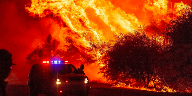
Detailed statistical records of wildfires managed by the Oregon Department of Forestry, covering occurrences from 2000 through 2022. This tabular resource offers critical insights into fire events, their locations, and determining factors. Data fields specify the general and specific causes of ignition—categorised primarily as human or lightning—along with geospatial coordinates, details on the fire area, the responsible administrative unit, and the size classification of the event. It is an essential resource for tracking fire history and trends across the state.
Columns
The dataset includes 38 columns, detailing various aspects of each incident:
- Serial: A unique serial number for the fire occurrence.
- FireCategory: Identifies the statistical fire category (e.g., STAT).
- FireYear: The calendar year in which the fire occurred, spanning 2000 to 2022.
- Lat_DD & Long_DD: Latitude and longitude coordinates indicating the fire's location.
- HumanOrLightning: The general determination of the fire cause (Human or Lightning). Approximately 73% of records indicate a Human cause.
- GeneralCause & SpecificCause: Detailed fields describing the ignition source (e.g., Equipment Use, Lightning).
- DistrictName & UnitName: Administrative names for the district and unit responsible for managing the fire event.
- Size_class: Classification of the fire size, with Class A being the most common (72% of records).
- EstTotalAcres & Protected_Acres: Measures of the estimated total acres affected and the acres under protection.
- Ign_DateTime, Discover_DateTime, Control_DateTime: Timestamps for when the fire was ignited, discovered, and controlled.
- County: The county where the wildfire occurred.
- FO_LandOwnType: Description of the land ownership type (e.g., Rural Residential, Industrial).
Distribution
This is a single tabular dataset, typically distributed in a file such as
fire-occurence.csv, with a size of approximately 10.62 MB. The file structure consists of 38 distinct columns. The data contains about 23,500 validated records, with new data expected to be updated annually.Usage
The data is ideal for analysing long-term trends in wildfire frequency, intensity, and geographical spread within Oregon. It can be used for spatial analysis and mapping fire risk zones based on ignition cause and location history. Applications include developing predictive models for human-caused fires, assessing the effectiveness of land use restrictions, and informing environmental planning and resource allocation for fire suppression and prevention strategies.
Coverage
This dataset provides geographical coverage for the state of Oregon. The temporal scope ranges from 2000 through to the end of 2022. The records pertain specifically to statistical wildfires documented and tracked by the Oregon Department of Forestry. Location data includes detailed coordinates (latitude and longitude), county information, township/range/section data, and regulatory use zone details.
License
CC0: Public Domain
Who Can Use It
- Environmental Scientists and Ecologists: For studying climatic impacts and vegetation recovery following different types of fire events.
- Disaster Management and Public Safety Agencies: For improving readiness, evacuation planning, and resource deployment during peak fire season.
- Urban and Rural Planners: For zoning and regulatory decision-making, especially concerning land use restrictions in high-risk areas.
- Academics and Researchers: For statistical modelling of fire probability and understanding the anthropogenic contribution to wildfire risk.
Dataset Name Suggestions
- Oregon ODF Wildfire Occurrences (2000-2022)
- Oregon Fire Cause, Location, and Size Data
- ODF Statistical Wildfire Records
Attributes
Original Data Source: ODF Statistical Wildfire Records
Loading...