Dark Mode

NYPD Public Safety Incident Data
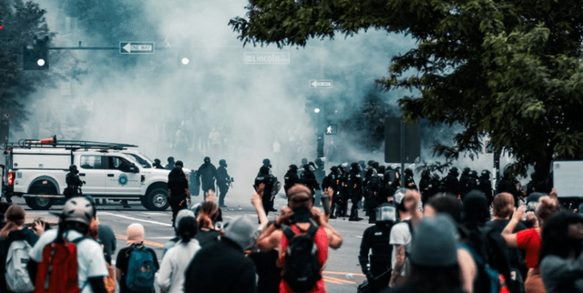
Public Safety & Security
Tags and Keywords
Trusted By


"No reviews yet"
Free
About
Detailed records explaining every shooting incident that occurred in New York City during 2022. The data is manually extracted every quarter and reviewed by the Office of Management Analysis and Planning before being publicly posted. Each record represents a valid incident that resulted in an injured victim, providing critical information about the event, its location, and the time of occurrence. Furthermore, the file includes demographic details related to the suspect (perpetrator) and the injured person (victim). This resource is valuable for exploring the nature of police enforcement activity and understanding urban violence patterns.
Columns
This file contains 26 data fields detailing incident specifics, location, and demographics:
- INCIDENT_KEY: A randomly generated persistent identification number for each incident.
- OCCUR_DATE: The exact date when the shooting incident took place.
- OCCUR_TIME: The precise time of the shooting incident.
- BORO: The New York City Borough where the incident occurred (e.g., BROOKLYN, BRONX).
- PRECINCT: The police precinct corresponding to the incident location.
- JURISDICTION_CODE: Identifies the jurisdiction, where codes 0, 1, and 2 represent NYPD jurisdictions (Patrol, Transit, Housing).
- LOCATION_DESC: A description of the exact location of the shooting incident.
- STATISTICAL_MURDER_FLAG: A Boolean flag indicating if the incident resulted in the victim's death, which would classify it as a murder.
- PERP_AGE_GROUP: The age group category of the perpetrator.
- PERP_SEX: Description of the perpetrator’s sex.
- PERP_RACE: Description of the perpetrator’s race.
- VIC_AGE_GROUP: The age group category of the victim (most commonly 25-44).
- VIC_SEX: Description of the victim’s sex (predominantly male).
- VIC_RACE: Description of the victim’s race (most commonly Black).
- X_COORD_CD, Y_COORD_CD: Midblock coordinates using the New York State Plane Coordinate System (NAD 83, Long Island Zone, units feet).
- Latitude, Longitude: Global coordinates provided in WGS 1984 decimal degrees.
Distribution
The data file is typically supplied in CSV format. The sample file size is approximately 329.1 kB and it contains 26 columns. The dataset includes 1,716 records. Data accuracy reflects the system of record as of the query date, and users should be aware that the information is an approximation due to potential revisions and updates. Geo-location data (Latitude/Longitude) is present for 99% of the records. Null values appear frequently in certain demographic fields, indicating information was not collected or was unknown at the time of reporting.
Usage
Ideal applications include detailed analysis of public safety trends in NYC, spatial mapping and identification of high-incident areas, assessment of police resource deployment, demographic studies correlating victim and perpetrator characteristics, and evaluating the effectiveness of crime reduction programmes. It can also be used for educational purposes related to urban criminology.
Coverage
Geographic Scope: New York City, geo-located by precinct and coordinates. Location data is approximate; for example, incidents near intersections are geo-located to the intersection, and those on Riker’s Island are uniformly mapped there. Matching approximate locations to exact street addresses is not advised.
Time Range: The dataset contains incident data spanning January 1, 2022, through December 31, 2022.
Demographic Scope: Covers age group, sex, and race for both victims and perpetrators.
License
CC0: Public Domain
Who Can Use It
Researchers and Academics: For conducting statistical modelling and causality studies related to urban violence.
Journalists and Investigative Reporters: To generate reports and visualisations on crime statistics and police activity.
City Agencies and Policy Makers: For making data-driven decisions regarding law enforcement strategy and public health intervention.
Dataset Name Suggestions
- NYC Verified Shooting Incidents (2022)
- NYPD Public Safety Incident Data
- New York City Gun Crime Records
Attributes
Original Data Source: NYPD Public Safety Incident Data
Loading...