Dark Mode

Drone-based Industrial Park Vehicle Congestion Detection Dataset
Synthetic Images & Vision Datasets
Tags and Keywords
"No reviews yet"
£8,000
About
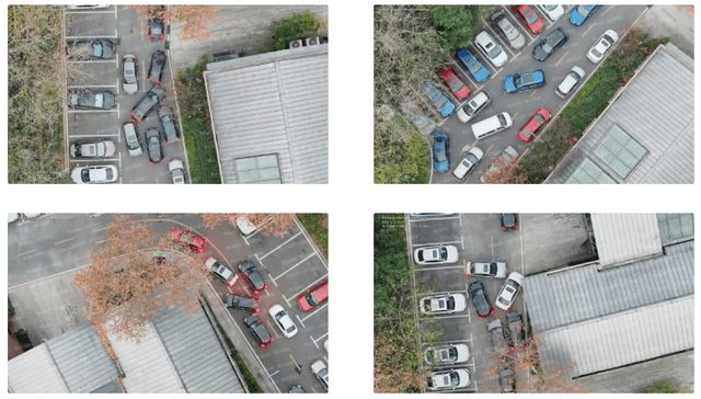
Description:
This specialized dataset is designed for the Intelligent Transportation Systems (ITS) and Smart City sectors, focusing on vehicle congestion detection within industrial parks, large-scale office districts, and logistics hubs. The data was captured using industrial-grade Unmanned Aerial Vehicles (UAV) from high-altitude, top-down perspectives, providing a comprehensive view of vehicle behavior in complex environments.
Keywords
Drone Vision, Industrial Park Traffic, Congestion Detection, Vehicle Counting, Intelligent Transportation, UAV Surveillance
Sector:
Smart City, Intelligent Transportation Systems (ITS), Industrial Automation, Logistics & Supply Chain, Security and Surveillance
Metrics:
Average Precision (AP) for Vehicle Detection, Vehicle Count Accuracy, Traffic Flow Density, Congestion Level Classification, Frame-to-Frame Tracking Consistency
Sample Images


Additional Notes & Services
- Usage Policy: Please adhere to all ethical standards and privacy regulations. Preprocessing may be required.
- Actively Maintained: This dataset is continuously updated. Contact us for the latest version.
- Full Customization Available: We can tailor image formats, annotations, and other specs to your project needs.
- Flexible Delivery: We offer split packages and delivery via private server or cloud storage.
- Free Sample Package: Available for qualified buyers to verify data quality.
- Contact Us: For inquiries, customization, or samples, email us at contact4data-project@join-intelligence.com
- Explore All Datasets: Visit our Notion Collection
- Official Website:https://join-intelligence.com/
Listing Stats
VIEWS
90
DELIVERY
SPECIFIED IN DESCRIPTION
LISTED
23/01/2026
UPDATED
23/01/2026
REGION
GLOBAL
![]() QUALITY
QUALITY
5 / 5
Loading...
£8,000
Download Dataset in Unknown Format
Recommended Datasets
Loading recommendations...