Dark Mode

Satellite-Derived Antarctic Ice Sheet Data
Synthetic Data Generation
Tags and Keywords
Trusted By


"No reviews yet"
Free
About
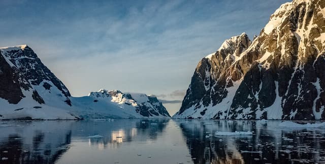
Satellite-based monitoring offers a crucial window into the changing state of the polar regions. This collection captures the mass of the Antarctic ice sheet, measured in gigatons, derived from observations spanning over two decades. Utilizing data from NASA's climate change monitoring initiatives, the file provides a monthly record of ice mass variations, essential for tracking environmental shifts and understanding the dynamics of global ice melt. The observations facilitate precise trend analysis in geophysical and climate studies.
Columns
- year: The specific decimal year of the observation, allowing for precise temporal sequencing (e.g., 2002.29).
- Antarctic mass: The measured mass of the Antarctic ice sheet expressed in gigatons, tracking the fluctuation of ice volume over time.
- Antarctic mass 1-sigma uncertainty: The uncertainty value associated with the mass measurement, indicating the statistical margin of error for each observation.
Distribution
- Format: CSV (
Antartica_mass.csv) - Size: 207.33 kB
- Structure: 226 valid records across 3 columns.
- Statistical Note: The dataset contains zero missing or mismatched values, ensuring high data integrity.
Usage
- Climate Change Modelling: Analysing long-term trends in polar ice reduction to refine global warming projections.
- Sea-Level Rise Forecasting: Correlating gigaton mass loss with potential sea-level changes.
- Academic Research: Supporting earth science dissertations and peer-reviewed studies on glaciology.
- Environmental Education: Visualising real-world data to teach students about the impacts of climate change.
- Data Journalism: Creating compelling infographics that demonstrate the scale of ice loss over the last twenty years.
Coverage
- Geographic: Antarctica.
- Time Range: 2002.29 to 2023.79 (Monthly observations).
- Scope: Geophysical mass measurements derived from satellite instrumentation.
License
CC0: Public Domain
Who Can Use It
- Climate Scientists: To validate models of ice sheet dynamics.
- Data Scientists: To practice time-series analysis and visualisation techniques on high-quality environmental data.
- Policy Makers: To access empirical evidence regarding the rate of environmental change in the Antarctic.
- Educators: To provide students with raw scientific data for STEM projects.
Dataset Name Suggestions
- NASA Antarctic Ice Mass Monthly Record
- Antarctic Gigaton Mass Variations (2002-2023)
- Satellite-Derived Antarctic Ice Sheet Data
- Monthly Antarctic Mass & Uncertainty Metrics
Attributes
Original Data Source: Satellite-Derived Antarctic Ice Sheet Data
Loading...