Dark Mode

Global Weekly Wildfire Burned Area
Data Science and Analytics
Tags and Keywords
Trusted By


"No reviews yet"
Free
About
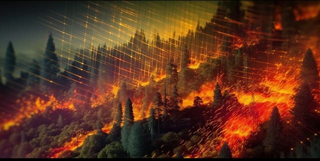
Tracks the weekly cumulative area of land burned by wildfires at a global and country level. A wildfire is defined as an uncontrolled burn of vegetation, including forests, grasslands, and croplands. This data is essential for understanding historical trends, identifying the start and peak of wildfire seasons in different regions, and comparing the extent of fires in the current year against previous years. The information is derived from satellite imagery and provides a high-resolution view of wildfire extent, which has significant impacts on human populations, ecosystems, and climate change.
Columns
- Entity: The name of the country.
- Code: The three-letter country code.
- Year: The year of the data record.
- Week: The week number of the year, from 1 to 52.
- area burnt by wildfires in [Year]: The cumulative area burned by wildfires for a specific year, from 2012 to 2024. This is repeated as a unique column for each year in the dataset.
Distribution
- Format: CSV file (
areaburntbywildfiresbyweek new.csv). - Size: 1.04 MB.
- Structure: The dataset contains 13,400 rows and 16 columns, documenting weekly wildfire data across 258 unique countries and entities.
Usage
This dataset is ideal for tracking the progression and extent of wildfires throughout the year. It allows for week-by-week comparisons to historical records, helping to identify whether fire seasons are starting earlier, lasting longer, or burning more area than in previous years. Key applications include climate change research, environmental impact analysis, disaster management planning, and public health studies focusing on air quality.
Coverage
- Geographic: Global, with data available at the country level for 258 different entities.
- Time Range: The dataset covers the period from 2012 to 2024.
- Demographic: Not applicable.
License
CC0: Public Domain
Who Can Use It
- Climate Scientists: To analyse the relationship between climate patterns and wildfire frequency and intensity.
- Environmental Analysts: To study the impact of fires on ecosystems and biodiversity.
- Government Agencies: For disaster preparedness, resource allocation, and policy-making related to land management and fire suppression.
- Data Journalists: To create interactive charts and reports on global fire trends for public awareness.
- Public Health Researchers: To investigate the health impacts of wildfire smoke and air pollution.
Dataset Name Suggestions
- Global Weekly Wildfire Burned Area
- Country-Level Wildfire Trends by Week
- Annual Wildfire Progression Data
- Historical Wildfire Burn Scar Area
- Weekly Cumulative Burned Land Area by Country
Attributes
Original Data Source: Global Weekly Wildfire Burned Area
Loading...
Free
Download Dataset in CSV Format
Recommended Datasets
Loading recommendations...