Dark Mode

Northwest Pacific Tropical Cyclone Data
Data Science and Analytics
Tags and Keywords
Trusted By


"No reviews yet"
Free
About
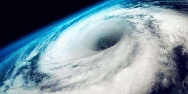
Satellite-retrieved data on tropical cyclones in the Northwest Pacific offers 6-hourly information on the position, intensity, and scale of these weather events from 1981 to 2016. The geographical scope of this information includes the area north of the equator and west of the 180° meridian, which covers the South China Sea. Version 2.0 of this data has been updated to only include samples at tropical storm strength or higher, specifically where near-centre maximum wind speeds are at least 17.2 m/s.
Columns
- code: A unique identifier for each cyclone, formatted as YYYYNNMMDDHH, where YYYY is the year, NN is a code, MM is the month, DD is the day, and HH is the hour.
- LAT: The latitude of the cyclone's centre.
- LONG: The longitude of the cyclone's centre.
- PRS: The lowest atmospheric pressure recorded for the cyclone.
- WND: The maximum sustained wind speed.
- SiR34: The radius of the area experiencing winds of at least 34 knots (nautical miles per hour).
- SATSer: The satellite sensor that recorded the data, such as GMS-4 or GMS-5.
Distribution
The data is provided as a single CSV file named
1980_2016_retrieved_TCsize_2Pub_v2.csv, with a file size of approximately 779.92 kB. It is structured into 7 columns and contains around 15,000 valid records, with no missing or mismatched data.Usage
This data is well-suited for meteorological studies, climate change research, and natural disaster modelling. It can be used for data visualisation projects to map cyclone paths and intensities over several decades. It is also valuable for statistical analysis and machine learning applications, such as clustering, to identify patterns in cyclone behaviour.
Coverage
The data covers the Northwest Pacific region, including the South China Sea, for the period between 1981 and 2016. The geographical area extends from the equator northwards and from the 180° meridian westwards.
License
CC0: Public Domain
Who Can Use It
- Climate Scientists can use this information to analyse long-term trends in cyclone frequency, intensity, and geographic distribution.
- Meteorologists can leverage historical cyclone data to enhance forecasting models.
- Data Analysts and Visualisation Experts can create compelling visualisations to illustrate the impact of tropical cyclones.
- Insurance and Risk Analysts can model the potential effects of cyclones on coastal areas to assess risk.
Dataset Name Suggestions
- Northwest Pacific Tropical Cyclone Data (1981-2016)
- Satellite-Retrieved Typhoon Data for the Northwest Pacific
- Historical Tropical Cyclone Tracks and Intensity (1981-2016)
- Chinese Typhoon Data Archive (1981-2016)
- Northwest Pacific Cyclone Intensity and Scale Dataset
Attributes
Original Data Source: Northwest Pacific Tropical Cyclone Data
Loading...
Free
Download Dataset in CSV Format
Recommended Datasets
Loading recommendations...