Dark Mode

Maritime Pollution Countermeasures Data
Data Science and Analytics
Tags and Keywords
Trusted By


"No reviews yet"
Free
About
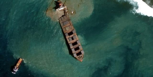
The data documents selected historical spill incidents occurring off US coastal waters, including details on the type of threat, cleanup measures deployed, and the potential maximum volume of material released. It serves as a vital record for understanding maritime pollution events and the government's intervention efforts over several decades.
Columns
- id: The unique identifier assigned to the incident.
- open_date: The specific date when OR&R was notified of the spill incident.
- name: The assigned name of the incident.
- location: The geographic location of the incident, generally provided as "City, State."
- lat: The latitude coordinate, which may be an approximate value.
- lon: The longitude coordinate, which may be an approximate value.
- threat: The primary classification of the threat, designated as "Oil," "Chemical," or "Other."
- tags: Descriptive labels assigned to the incident, often detailing the cause, such as Grounding, Pipeline, or Hurricane. Multiple tags are separated by a pipe symbol (
|). - commodity: A freeform text description of the specific item or material that was spilled.
- is_measure_skim: A boolean value (1 for true, 0 for false) indicating whether On-Water Recovery (skimming) was utilised as a countermeasure.
- is_measure_shore: A boolean value indicating whether Shoreline Cleanup was performed.
- is_measure_bio: A boolean value indicating whether Bioremediation was employed.
- is_measure_disperse: A boolean value indicating whether Dispersants were used.
- is_measure_burn: A boolean value indicating whether In-Situ Burning was used.
- max_ptl_release_gallons: The maximum potential volume of material released, quantified in gallons. If the release amount is unknown or cannot be converted to gallons (e.g., if reported in mass units), this field will be blank.
- posts: The quantity of associated posts published in IncidentNews.
- description: A detailed text explanation of the incident.
Distribution
The data file is typically supplied in CSV format, adhering to UTF-8 character encoding and Excel formatting standards. Boolean values are represented numerically (1 for true, 0 for false). Dates follow the "YYYY-MM-DD" structure. Blank cells ("") denote null values. The dataset includes 17 columns and contains 4210 valid records for core fields.
Usage
This data is ideal for:
- Historical risk assessment and modeling of maritime incidents.
- Evaluating the efficacy and frequency of various spill countermeasures (e.g., skimming versus dispersants).
- Geographic pattern analysis of pollution hotspots off the US coastline.
- Supporting environmental policy development related to oil and chemical transport safety.
Coverage
The data focuses exclusively on incidents occurring off US coastal waters. The records span a significant historical period, starting from March 1957 and running through to March 2022. While it captures a large number of incidents, it is limited to those where NOAA's OR&R offered scientific response assistance. Note that release estimates (gallons) are missing for 46% of the records.
License
CC0: Public Domain
Who Can Use It
- Environmental Researchers: To study the long-term impacts and frequencies of marine pollution.
- Maritime Safety Analysts: To identify common causes (tags like Grounding or Pipeline) leading to spills.
- Governmental/Regulatory Bodies: To inform decisions regarding spill response protocols and resource allocation.
- Students and Academics: For environmental science projects and case studies on pollution.
Dataset Name Suggestions
- US Coastal Spill Incidents (1957-2022)
- NOAA Historical Oil & Chemical Incidents
- Maritime Pollution Countermeasures Data
- US Coastal Water Threat Log
Attributes
Original Data Source: Maritime Pollution Countermeasures Data
Loading...
Free
Download Dataset in CSV Format
Recommended Datasets
Loading recommendations...