Dark Mode

Historical US Tornado Data
Data Science and Analytics
Tags and Keywords
Trusted By


"No reviews yet"
Free
About
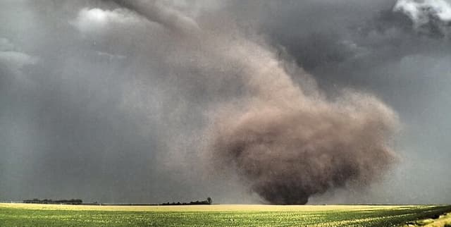
This dataset provides detailed records of tornadic activity in the United States spanning seven decades, from 1950 to 2021. Tornadoes are a frequent and destructive weather phenomenon in the US, particularly in the central and southeastern states, often referred to as "Tornado Alley". Their destructive power is primarily due to wind speed, which meteorologists measure using scales. Historically, tornadoes in the US were rated on the Fujita Scale, with the Enhanced Fujita Scale being adopted from February 2007 onwards. This data allows for in-depth analysis of tornado occurrences, their severity, and impact. The dataset was originally compiled from information produced by NOAA's Storm Prediction Center, with subsequent modifications including column deletions, data type changes, and chronological sorting.
Columns
- yr: Four-digit year of the tornado event.
- mn: Month of the tornado event (1-12).
- dy: Day of the month of the tornado event.
- date: Datetime object representing the date of the tornado event (e.g., 1950-01-01).
- st: Two-digit abbreviation for the US state where the tornado originated.
- mag: Magnitude rating of the tornado. This refers to the F rating up to January 2007, and the EF rating thereafter. A value of -9 indicates an unknown rating.
- inj: The total number of injuries caused by the tornado.
- fat: The total number of fatalities caused by the tornado.
- slat: Starting latitude of the tornado track in decimal degrees.
- slon: Starting longitude of the tornado track in decimal degrees.
- elat: Ending latitude of the tornado track in decimal degrees (0 if missing).
- elon: Ending longitude of the tornado track in decimal degrees (0 if missing).
- len: Length of the tornado's track in miles.
- wid: Width of the tornado in yards.
Distribution
The dataset is provided as a CSV file named
us_tornado_dataset_1950_2021.csv. It has a file size of 44.24 MB and contains 14 columns across approximately 67,600 records.Usage
This dataset is ideal for:
- Exploratory data analysis of tornado patterns.
- Studying the frequency, intensity, and geographical distribution of tornadoes in the US.
- Analysing the impact of tornadoes in terms of injuries and fatalities.
- Historical weather research and climate studies.
- Developing predictive models for tornado risk assessment.
Coverage
The dataset covers tornadic activity exclusively within the United States, encompassing events from January 1950 through to December 2021. Geographic data includes starting and ending latitudes and longitudes, along with the state of origin. There are no specific notes on data availability for particular demographic groups, as this is a meteorological dataset.
License
CC0: Public Domain
Who Can Use It
This dataset is suitable for a wide range of users, including:
- Data scientists and analysts performing exploratory data analysis.
- Meteorologists and climate researchers studying weather phenomena.
- Students and educators for academic projects related to environmental science, statistics, or programming.
- Individuals interested in natural disasters and their societal impact.
Dataset Name Suggestions
- US Tornado Activity 1950-2021
- Historical US Tornado Data
- American Tornado Events (1950-2021)
- Tornado Alley Occurrences
- United States Tornado Record (1950-2021)
Attributes
Original Data Source: Historical US Tornado Data
Loading...
Free
Download Dataset in CSV Format
Recommended Datasets
Loading recommendations...