Dark Mode

Floodwater Region Detection
Data Science and Analytics
Tags and Keywords
Trusted By


"No reviews yet"
Free
About
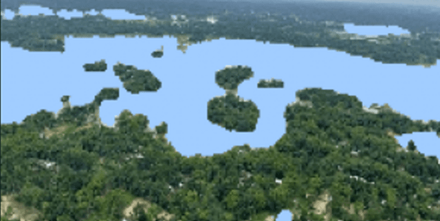
This dataset focuses on flood area segmentation, providing a valuable resource for developing models capable of accurately identifying water regions in flood-affected areas. It comprises images of flood-hit scenes paired with corresponding mask images that precisely delineate the water. The dataset was created to enable the development of segmentation models, which are crucial tools for effective flood surveys, improved decision-making, and strategic planning in disaster management. Given the dataset's size of 290 images, users may find it beneficial to employ pre-trained models and data augmentation techniques to enhance model performance.
Columns
The dataset is structured with a metadata CSV file that maps images to their corresponding masks, alongside dedicated folders for the image and mask files.
- Image: This column in
metadata.csvlists the name of each flood image. There are 290 unique image names, all of which are valid. - Mask: This column in
metadata.csvlists the name of each segmentation mask image. Like the image column, it contains 290 unique mask names, all valid and correctly linked. The dataset also includes anImagefolder containing all the flood images and aMaskfolder containing all the mask images, with masks self-annotated using Label Studio.
Distribution
The dataset consists of 290 flood images and 290 corresponding self-annotated mask images. The images and masks are organised into separate folders,
Image and Mask, respectively. A metadata.csv file, approximately 5.3 kB in size, links each image name to its mask name. The dataset is static and is not expected to receive future updates.Usage
This dataset is ideal for training and validating image segmentation models. Potential applications include:
- Developing AI models to automatically segment water regions in flood imagery.
- Conducting detailed flood surveys to assess affected areas and damage.
- Informing better decision-making and planning for flood response and mitigation efforts.
- Research and development in computer vision for environmental monitoring.
- Educational purposes, demonstrating practical applications of image segmentation.
Coverage
The dataset consists of 290 images and self-annotated masks capturing flood-hit areas. The scope is general to flood areas, without specific geographic or temporal constraints mentioned. The data focuses on visual representation of flooded regions.
License
CC0: Public Domain
Who Can Use It
This dataset is suitable for:
- Data Scientists and Machine Learning Engineers: For building and refining image segmentation models.
- Researchers: Studying computer vision, remote sensing, and environmental disaster management.
- Government Agencies and NGOs: For tools to aid in flood assessment, disaster preparedness, and response planning.
- Educators and Students: As a practical resource for learning about image processing, deep learning, and real-world AI applications.
Dataset Name Suggestions
- Flood Area Image Segmentation
- Floodwater Region Detection
- Environmental Flood Imagery
- Disaster Zone Water Segmentation
Attributes
Original Data Source:Floodwater Region Detection
Loading...
Free
Download Dataset in ZIP Format
Recommended Datasets
Loading recommendations...