Dark Mode

World Weather Astronomy and Solar-Lunar Metrics
Data Science and Analytics
Tags and Keywords
Trusted By


"No reviews yet"
Free
About
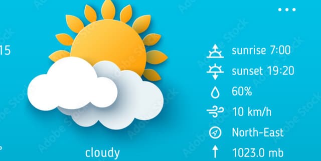
Astronomical and regional temporal details are captured across various global locations to provide insights into daily solar and lunar cycles. By integrating up-to-date information on sunrise, sunset, moonrise, and moon phase with geographical coordinates and timezones, this resource facilitates the study of how celestial events correlate with specific regions. It serves as a valuable tool for understanding global temporal variations and provides the necessary parameters for predictive modelling between location-based data and astronomical phenomena.
Columns
- serial number: A unique numerical identifier assigned to each record in the sequence.
- name: The full or historical name of the country.
- region: The specific region or capital city associated with the location.
- country: The official name of the country.
- lat: The latitude coordinate of the place.
- lon: The longitude coordinate of the place.
- tz_id: The specific timezone identifier for the location.
- localtime_epoch: The local time expressed as a Unix epoch.
- localtime: The current local time at the specified location.
- sunrise: The specific time at which the sun rises for that date.
Distribution
The data is provided in a CSV file titled countryAstronomy.csv with a total size of 35.03 kB. It contains 238 valid records, with high integrity across most fields, though approximately 23% of the region data is missing. The material is scheduled for quarterly updates to maintain accuracy and holds a usability rating of 10.00.
Usage
Analysts can employ this information to develop machine learning models that predict a country or region based on specific astronomical features. It is also suitable for applications requiring local time synchronisation or celestial event tracking for logistical planning. Researchers can explore the relationship between geographical coordinates and solar or lunar cycles for environmental studies.
Coverage
The scope includes 211 unique countries and 176 unique regions globally. Geographic coordinates cover latitudes ranging from approximately -54 to 64 and longitudes from -176 to 179. The temporal focus captures local times and celestial events recorded around February 2023.
License
CC0: Public Domain
Who Can Use It
Beginner data scientists can use these records to practice building classification or regression models using tools like scikit-learn. Astronomers and meteorologists can utilise the tabular details for site-specific observation planning. Additionally, software developers can integrate these metrics into weather and mapping applications to provide users with accurate local celestial information.
Dataset Name Suggestions
- Global Astronomical and Regional Temporal Index
- World Weather Astronomy and Solar-Lunar Metrics
- Geographic Timezone and Celestial Event Database
- Regional Sunrise and Moon Phase Tabular Records
Attributes
Original Data Source: World Weather Astronomy and Solar-Lunar Metrics
Loading...