Dark Mode

LST & Elevation Data for Marmara – Feature Set
Data Science and Analytics
Tags and Keywords
Trusted By


"No reviews yet"
Free
About
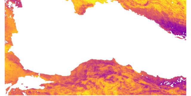
Geospatial data features created by integrating satellite remote sensing observations with topographical inputs. The primary purpose of this product is to support advanced machine learning and remote sensing studies focusing on the Marmara region of Turkey. The dataset merges NASA MODIS Land Surface Temperature (MOD11A1) and vegetation data (NDVI/EVI from MOD13A2) with high-resolution elevation readings from the SRTM Digital Elevation Model (DEM).
Columns
The dataset contains 15 distinct features detailing atmospheric and surface characteristics for each observed pixel:
- Latitude: Geographic latitude, expressed in degrees.
- Longitude: Geographic longitude, expressed in degrees.
- LST_Day: Daytime Land Surface Temperature, measured in Kelvin.
- LST_Night: Nighttime Land Surface Temperature, measured in Kelvin.
- LST_Diff: The calculated difference between day and night LST.
- Emis_31: Thermal emissivity derived from MODIS band 31.
- Emis_32: Thermal emissivity derived from MODIS band 32.
- NDVI: Normalised Difference Vegetation Index.
- EVI: Enhanced Vegetation Index.
- NDWI: Normalised Difference Water Index.
- Sun_Angle: Sun zenith angle, expressed in degrees.
- Albedo_Diff: Difference between black-sky albedo (BSA) and white-sky albedo (WSA) shortwave albedo.
- View_Angle: Sensor view zenith angle, expressed in degrees.
- Rel_Azimuth: Relative azimuth angle between the sun and the sensor.
- DEM: Elevation data from SRTM, measured in metres.
Distribution
The cleaned dataset is distributed in a CSV file format named
final_features_dataset.csv. The file contains approximately 23.8 thousand valid records, each holding the 15 defined features. The file size is 4.21 MB. The data product has an expected update frequency of monthly.Usage
This data product is ideally suited for several applications, including:
- Developing predictive machine learning models related to surface temperature anomalies.
- Geospatial analysis and advanced remote sensing research.
- Climate modelling studies requiring integrated LST and topographical information.
- Educational use in environmental science and data analytics courses.
Coverage
The data collection focuses exclusively on the Marmara region of Turkey. The observations reflect a specific snapshot in time, captured on July 29, 2024. The geographic bounds generally span latitudes from 40 degrees to 42 degrees and longitudes from 27 degrees to 29 degrees.
License
Attribution 4.0 International (CC BY 4.0)
Who Can Use It
- Data Scientists: Requiring feature-rich datasets for training and validating geospatial machine learning algorithms.
- Academics and Researchers: Conducting studies in Earth science, land cover change, or regional climate dynamics.
- Environmental Consultants: Analysing the relationship between elevation, vegetation cover, and temperature patterns in the specified region.
Dataset Name Suggestions
- MODIS LST & SRTM DEM Dataset for Marmara
- Marmara Land Surface Temperature and Elevation
- LST & Elevation Data for Marmara – Feature Set
Attributes
Original Data Source: LST & Elevation Data for Marmara – Feature Set
Loading...
Free
Download Dataset in CSV Format
Recommended Datasets
Loading recommendations...