Dark Mode

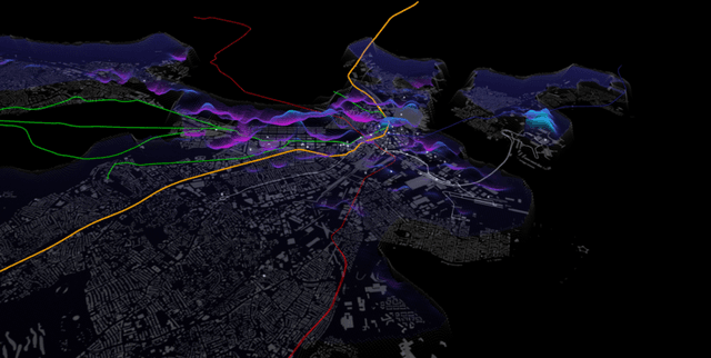
Rome Taxi Trajectory and Mobility Subset
Tranportation & Public Transport
Tags and Keywords
Trusted By


"No reviews yet"
Free
About
Analysing the movement of public transport in urban environments offers vital insights into how cities breathe and move. This collection captures the digital footprints of taxi cabs operating within the metropolitan area of Rome, Italy. By recording specific GPS coordinates at precise moments, the data provides a window into spatiotemporal mobility patterns and individual driving behaviours. Such trajectory information is instrumental for identifying bottlenecks in urban road networks and optimising city-wide transport services.
Columns
- row_ID: A unique numerical identifier for each entry in the record set.
- DriveNo: A unique numeric ID assigned to each individual taxi driver.
- Date and Time: The precise temporal marker for the location recording, including microseconds and time-zone adjustments.
- Longitude: The explicit geographical coordinate representing the east-west position of the vehicle.
- Latitude: The explicit geographical coordinate representing the north-south position of the vehicle.
Distribution
The information is provided in a single CSV file named
taxi_data_subset.csv, with a total size of 681.2 kB. It contains exactly 10,000 valid records structured across 5 distinct columns. The data exhibits high integrity with a 100% validity rate for its identifiers, timestamps, and coordinates. This is a static subset with no future updates expected.Usage
This resource is ideal for performing geospatial analysis to map high-traffic areas and common taxi routes within a historic European city. It is well-suited for researchers conducting fractal analysis to uncover the underlying intelligence of driver mobility patterns. Additionally, urban planners can use the trajectory information to simulate traffic flow, while data scientists can utilise the precise timestamps to practice time-series forecasting and trajectory prediction.
Coverage
The geographic scope is focused on the metropolitan city of Rome, Italy. Temporally, the records capture mobility traces from early 2014, specifically around the 31st of January and the 1st of February. The data represents the movements of taxi drivers equipped with GPS devices during this specific window, providing a high-resolution snapshot of urban transit.
License
CC0: Public Domain
Who Can Use It
Urban planners can leverage these records to address road network problems and improve public transport infrastructure. Commercial organisations may utilise the mobility patterns to optimise delivery routes or site selection for new businesses. Furthermore, academic researchers and students can use the clean, structured format to study human mobility and develop advanced geospatial algorithms.
Dataset Name Suggestions
- Rome Taxi Trajectory and Mobility Subset
- Metropolitan Rome GPS Mobility Traces
- Urban Taxi Transit Patterns: Rome 2014
- Spatiotemporal Mobility Analysis of Rome Cabs
- Rome Taxi Driver GPS Footprint Data
Attributes
Original Data Source: Rome Taxi Trajectory and Mobility Subset
Loading...
Free
Download Dataset in CSV Format
Recommended Datasets
Loading recommendations...