Dark Mode

France 1999 Municipal Census and Spatial Data Set
Census & Demographics
Tags and Keywords
Trusted By


"No reviews yet"
Free
About
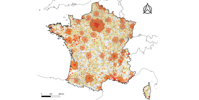
Detailed mapping of the French Republic’s urban landscape in 1999 provides a snapshot of population distribution across Western Europe and various overseas territories. By cataloguing cities through their geographic coordinates, postal codes, and inhabitant counts, the records offer a foundational look at the demographic spread at the turn of the millennium. This resource is vital for those conducting historical spatial analysis or creating cartographic representations of French settlement patterns.
Columns
- Index: A unique numerical identifier assigned to each entry in the collection.
- Postal Code: The official zip code identifying the specific French city or municipality.
- x (Longitude): The horizontal geographic coordinate, with values normalised between -1 and 1.
- y (Latitude): The vertical geographic coordinate, with values normalised between -1 and 1.
- iseecode: The ISEE administrative code used for official classification of French territories.
- place: The common name of the city or town.
- population: The total number of inhabitants residing in the city during the 1999 census.
- surface: The total land area of the municipality measured in square kilometres.
- altitude: The recorded height of the city relative to sea level.
Distribution
The information is delivered in a CSV file titled
villes.csv, which has a file size of approximately 2.53 MB. The collection contains 36,551 records structured across nine distinct columns. This resource has achieved a usability score of 10.00 and is maintained as a static archive with no future updates scheduled.Usage
This collection is ideal for creating thematic maps that visualise population density and urban sprawl across the French Republic. It is well-suited for statistical analysis aimed at understanding late-20th-century demographic shifts. Additionally, developers can utilise the normalised longitude and latitude coordinates to build custom geographic search tools or to practice geospatial data processing.
Coverage
The geographic scope includes the entirety of France, encompassing both mainland Europe and overseas regions. Temporally, the data provides a specific snapshot of the year 1999. The demographic scope covers the population distribution of all registered cities and municipalities within the French Republic at that time.
License
CC0: Public Domain
Who Can Use It
Historians can leverage these records to study the demographic evolution of French municipalities over the last few decades. Urban planners may utilise the surface area and population counts to assess historical land-use efficiency. Furthermore, data science students can use the normalised coordinate system to practice feature scaling and geographic clustering algorithms.
Dataset Name Suggestions
- 1999 French Cities: Population and Geographic Registry
- French Republic Demographics and Cartographic Metrics (1999)
- Historical French Urban Population and Coordinates Archive
- France 1999 Municipal Census and Spatial Data Set
- Geographic Distribution of the French Population: 1999 Snapshot
Attributes
Original Data Source: France 1999 Municipal Census and Spatial Data Set
Loading...
Free
Download Dataset in CSV Format
Recommended Datasets
Loading recommendations...