Dark Mode

Global Forest Fire Patterns and FWI System Metrics
Environmental Monitoring
Tags and Keywords
Trusted By


"No reviews yet"
Free
About
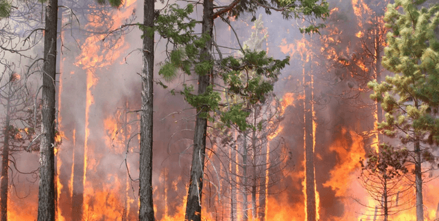
Predicting the occurrence and behaviour of wildfires is vital for protecting diverse ecosystems and human settlements. This collection of meteorological and spatial records provides the foundation for understanding how environmental and socioeconomic factors influence the ignition and spread of fires. By examining specific coordinates and indices from the Fire Weather Index (FWI) system, users can identify patterns that contribute to the intensity and duration of these natural hazards. The information facilitates the development of strategies to mitigate the devastating impacts of fire on local economies and environments.
Columns
- x: The horizontal spatial coordinate within the Montesinho park map, ranging from 1 to 9.
- y: The vertical spatial coordinate within the Montesinho park map, ranging from 2 to 9.
- month: The specific month of the year, from January through to December.
- day: The specific day of the week, from Monday through to Sunday.
- ffmc: The Fine Fuel Moisture Code index from the FWI system, representing fuel moisture of surface litter.
- dmc: The Duff Moisture Code index from the FWI system, indicating the moisture content of shallow organic layers.
- dc: The Drought Code index from the FWI system, reflecting the moisture content of deep, compact organic layers.
- isi: The Initial Spread Index from the FWI system, used to estimate the rate of fire spread.
- temp: The recorded outside temperature measured in degrees Celsius.
- rh: The relative humidity percentage recorded in the area.
Distribution
The information is delivered in a comma-separated values file titled
forestfires.csv, with a total file size of approximately 26 kB. The record set includes 517 valid entries across 13 primary columns. All core metrics demonstrate 100% validity with no missing or mismatched data points. The resource holds a maximum usability score of 10.00 and is maintained as a static historical archive with no future updates expected.Usage
This resource is ideal for training regression models to forecast the spatial distribution and severity of wildfires. It is well-suited for researchers investigating the correlation between climate change and land-use patterns on fire frequency. Furthermore, policymakers can utilise the figures to pinpoint high-risk zones and refine emergency response protocols. Analysts might also use the seasonal and weekly markers to identify specific windows of time where human-caused fires are most prevalent.
Coverage
The geographic scope is focused on the Montesinho natural park, utilizing a coordinate system to map specific locations. Temporally, the data captures a full annual cycle from January to December. The scope encompasses various forest types and accounts for both natural and human-induced fire events, providing a broad view of the drivers behind fire dynamics in a protected ecological area.
License
Attribution 4.0 International (CC BY 4.0)
Who Can Use It
Environmental researchers can leverage these records to study the ecological impacts of fire on different types of forest biomes. Policymakers may utilise the trends identified in the data to develop targeted prevention strategies for specific regions. Additionally, data science students and machine learning practitioners can use the structured meteorological indices to practice building predictive algorithms for natural disaster management.
Dataset Name Suggestions
- Montesinho Wildfire Dynamics and Meteorological Log
- Global Forest Fire Patterns and FWI System Metrics
- Predictive Modelling for Forest Fire Occurrence
- Natural Disaster Archive: Forest Fire Drivers and Trends
- Montesinho Park Fire Weather and Spatial Data
Attributes
Original Data Source: Global Forest Fire Patterns and FWI System Metrics
Loading...
Free
Download Dataset in CSV Format
Recommended Datasets
Loading recommendations...